Distance to Standish, California

Calculating Your Route
Just a moment while we process your request...
Location Information
-
Full AddressStandish, CA 96130
-
Coordinates40.3651768, -120.4221645
-
LocationStandish , California , US
-
TimezoneAmerica/Los_Angeles
-
Current Local Time8:20:34 PM America/Los_AngelesThursday, June 19, 2025
-
Page Views0
About Standish
Standish is an unincorporated town in Lassen County, California. It is located 2.25 miles southwest of Litchfield, at an elevation of 4,049 feet. It lies at the northern terminus of County Route A3 on U.S. Route 395. The name honors Miles Standish.


Nearby Places
Found 10 places within 50 miles

Litchfield
2.1 mi
3.4 km
Litchfield, CA
Get directions

Janesville
8.3 mi
13.4 km
Janesville, CA
Get directions

Johnstonville
9.0 mi
14.5 km
Johnstonville, CA 96130
Get directions

Wendel
10.0 mi
16.1 km
Wendel, CA 96136
Get directions

Susanville
12.7 mi
20.4 km
Susanville, CA
Get directions

Milford
13.6 mi
21.9 km
Milford, CA 96121
Get directions
Karlo
14.0 mi
22.5 km
Karlo, CA 96117
Get directions
Horse Lake Mountain
17.0 mi
27.4 km
Horse Lake Mountain, California 96130
Get directions
Patton Village
20.2 mi
32.5 km
Patton Village, CA
Get directions

Herlong
21.5 mi
34.6 km
Herlong, CA 96113
Get directions
Location Links
Local Weather
Weather Information
Coming soon!
Location Map
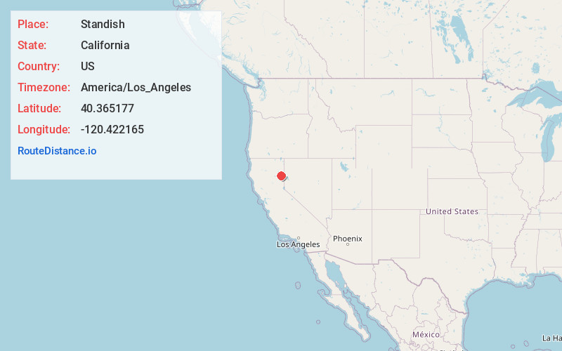
Static map view of Standish, California
Browse Places by Distance
Places within specific distances from Standish
Short Distances
Long Distances
Click any distance to see all places within that range from Standish. Distances shown in miles (1 mile ≈ 1.61 kilometers).