Distance to Topsy, Tennessee

Calculating Your Route
Just a moment while we process your request...
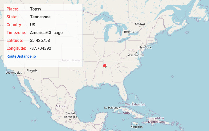
Location Information
-
Full AddressTopsy, TN 38485
-
Coordinates35.425758, -87.704392
-
LocationTopsy , Tennessee , US
-
TimezoneAmerica/Chicago
-
Current Local Time6:38:35 AM America/ChicagoMonday, June 30, 2025
-
Page Views0
About Topsy
Topsy is an unincorporated community located in Wayne County, Tennessee.
A volunteer fire department and a small store are located in Topsy.
Topsy was named after a local mule noticed by the naming committee when they were unable to come up with another suitable name.
Nearby Places
Found 10 places within 50 miles

Ashland
2.2 mi
3.5 km
Ashland, TN 38485
Get directions
Ruppertown
6.2 mi
10.0 km
Ruppertown, TN 38462
Get directions
Turkey Track
7.8 mi
12.6 km
Turkey Track, TN 38464
Get directions

Waynesboro
8.0 mi
12.9 km
Waynesboro, TN 38485
Get directions
Voorhies
8.2 mi
13.2 km
Voorhies, TN 38462
Get directions
Leatherwood Branch
8.4 mi
13.5 km
Leatherwood Branch, Tennessee 38425
Get directions
Shubert
10.6 mi
17.1 km
Shubert, TN 38462
Get directions
Mooney
10.7 mi
17.2 km
Mooney, TN 38425
Get directions
Sugar Hill
10.9 mi
17.5 km
Sugar Hill, TN 37096
Get directions

Laurel Hill Lake
10.9 mi
17.5 km
Laurel Hill Lake, Tennessee 38464
Get directions
Location Links
Local Weather
Weather Information
Coming soon!
Location Map
Static map view of Topsy, Tennessee
Browse Places by Distance
Places within specific distances from Topsy
Short Distances
Long Distances
Click any distance to see all places within that range from Topsy. Distances shown in miles (1 mile ≈ 1.61 kilometers).