Distance to Tyson, Missouri

Calculating Your Route
Just a moment while we process your request...
Location Information
-
Full AddressTyson, Meramec Township, MO 63025
-
Coordinates38.5369981, -90.5617906
-
LocationMeramec Township , Missouri , US
-
TimezoneAmerica/Chicago
-
Current Local Time4:59:08 AM America/ChicagoSunday, June 22, 2025
-
Page Views0
Nearby Places
Found 10 places within 50 miles

Lincoln Beach
1.4 mi
2.3 km
Lincoln Beach, Meramec Township, MO 63021
Get directions
Morschels
1.4 mi
2.3 km
Morschels, Meramec Township, MO 63049
Get directions
Mountain Ridge
1.4 mi
2.3 km
Mountain Ridge, Meramec Township, MO 63021
Get directions
Sherman
1.6 mi
2.6 km
Sherman, MO 63021
Get directions
Fern Glen
1.9 mi
3.1 km
Fern Glen, Queeny Township, MO 63021
Get directions
Pettys Hill
3.1 mi
5.0 km
Pettys Hill, Valley Park, MO 63088
Get directions
Peerless Park
3.6 mi
5.8 km
Peerless Park, Valley Park, MO 63088
Get directions

Valley Park
3.8 mi
6.1 km
Valley Park, MO
Get directions
Twin Oaks
4.0 mi
6.4 km
Twin Oaks, MO
Get directions

Ellisville
4.1 mi
6.6 km
Ellisville, MO
Get directions
Location Links
Local Weather
Weather Information
Coming soon!
Location Map
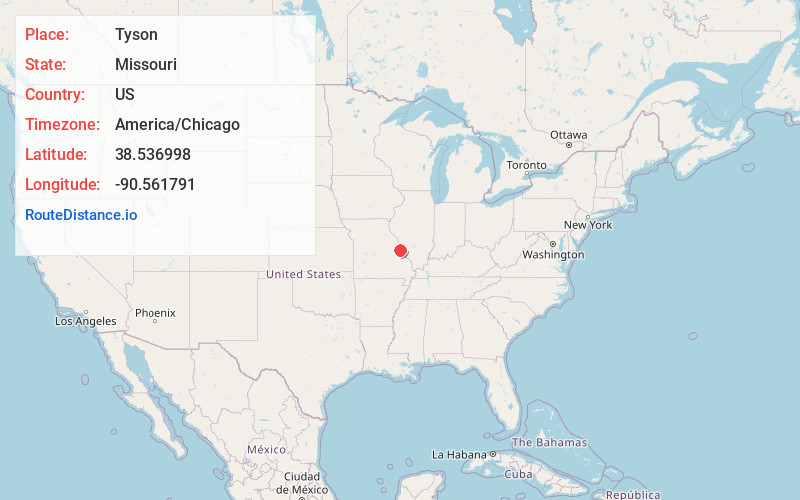
Static map view of Tyson, Missouri
Browse Places by Distance
Places within specific distances from Tyson
Short Distances
Long Distances
Click any distance to see all places within that range from Tyson. Distances shown in miles (1 mile ≈ 1.61 kilometers).