Distance to Upperco, Maryland

Calculating Your Route
Just a moment while we process your request...
Location Information
-
Full AddressUpperco, MD 21155
-
Coordinates39.5628814, -76.835255
-
LocationUpperco , Maryland , US
-
TimezoneAmerica/New_York
-
Current Local Time12:01:54 PM America/New_YorkThursday, June 19, 2025
-
Page Views0
About Upperco
Upperco is an unincorporated community in Baltimore and Carroll counties, Maryland, United States. The population as of the 2000 census for zip code 21155, part of which covers Upperco, was 2349. It is adjacent to Maryland Route 30, between the much larger towns of Reistertown and Hampstead.


Nearby Places
Found 10 places within 50 miles

Trenton Mill
1.6 mi
2.6 km
Trenton Mill, MD 21155
Get directions
Trenton
1.8 mi
2.9 km
Trenton, MD 21155
Get directions
Lees Mill
2.0 mi
3.2 km
Lees Mill, MD 21155
Get directions
Houcksville
2.5 mi
4.0 km
Houcksville, MD 21074
Get directions

Hampstead
3.0 mi
4.8 km
Hampstead, MD 21074
Get directions
Hoffmans Mill
3.2 mi
5.1 km
Hoffmans Mill, MD 21074
Get directions
Lawndale
3.6 mi
5.8 km
Lawndale, MD 21048
Get directions
Armacost
3.9 mi
6.3 km
Armacost, MD 21074
Get directions
Whitehouse
4.2 mi
6.8 km
Whitehouse, MD 21155
Get directions
Carrollton
4.4 mi
7.1 km
Carrollton, MD 21157
Get directions
Location Links
Local Weather
Weather Information
Coming soon!
Location Map
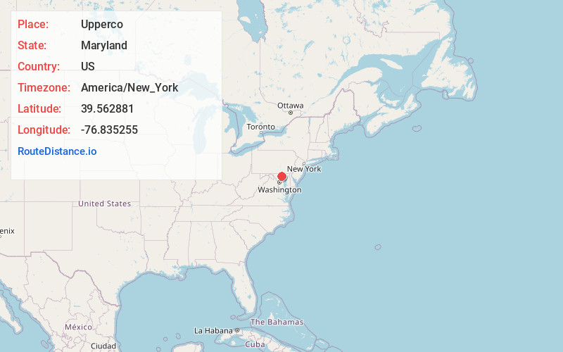
Static map view of Upperco, Maryland
Browse Places by Distance
Places within specific distances from Upperco
Short Distances
Long Distances
Click any distance to see all places within that range from Upperco. Distances shown in miles (1 mile ≈ 1.61 kilometers).