Distance to Vinland, Kansas

Calculating Your Route
Just a moment while we process your request...
Location Information
-
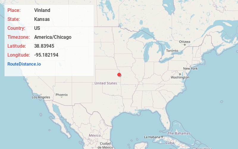
Full AddressVinland, Palmyra Township, KS 66006
-
Coordinates38.83945, -95.1821935
-
LocationPalmyra Township , Kansas , US
-
TimezoneAmerica/Chicago
-
Current Local Time12:51:16 AM America/ChicagoThursday, June 19, 2025
-
Page Views0
About Vinland
Vinland is an unincorporated community in Douglas County, Kansas, United States. It is located south of Lawrence and north of Baldwin City.
Nearby Places
Found 10 places within 50 miles

Sibleyville
3.2 mi
5.1 km
Sibleyville, Wakarusa Township, KS 66046
Get directions

Baldwin City
4.5 mi
7.2 km
Baldwin City, KS 66006
Get directions
Clearfield
4.9 mi
7.9 km
Clearfield, Palmyra Township, KS 66025
Get directions
Black Jack
6.1 mi
9.8 km
Black Jack, KS 66092
Get directions
Broken Arrow Park
7.0 mi
11.3 km
Broken Arrow Park, Lawrence, KS 66046
Get directions
Hesper
7.1 mi
11.4 km
Hesper, Eudora Township, KS 66025
Get directions
Noria
7.6 mi
12.2 km
Noria, Lawrence, KS 66046
Get directions

Eudora
8.5 mi
13.7 km
Eudora, KS 66025
Get directions
Worden
9.0 mi
14.5 km
Worden, KS 66006
Get directions

Lawrence
9.6 mi
15.4 km
Lawrence, KS
Get directions
Location Links
Local Weather
Weather Information
Coming soon!
Location Map
Static map view of Vinland, Kansas
Browse Places by Distance
Places within specific distances from Vinland
Short Distances
Long Distances
Click any distance to see all places within that range from Vinland. Distances shown in miles (1 mile ≈ 1.61 kilometers).