Distance to Wilder, Kentucky

Calculating Your Route
Just a moment while we process your request...
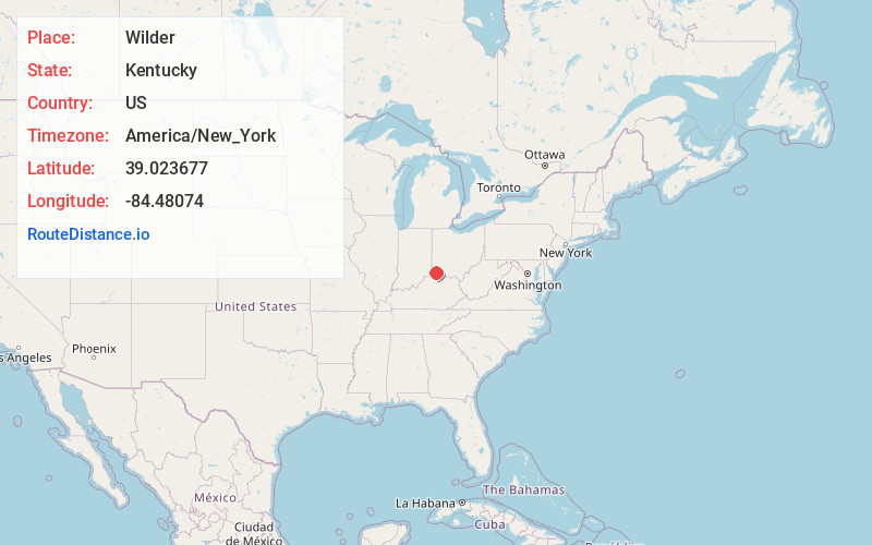
Location Information
-
Full AddressWilder, KY
-
Coordinates39.0236772, -84.4807399
-
LocationWilder , Kentucky , US
-
TimezoneAmerica/New_York
-
Current Local Time4:31:18 AM America/New_YorkFriday, June 20, 2025
-
Page Views2
About Wilder
Wilder is a home rule-class city in Campbell County, Kentucky, United States. The population was 3,176 at the 2020 census. It is part of the Cincinnati-Northern Kentucky metropolitan area.


Nearby Places
Found 10 places within 50 miles

Highland Heights
1.7 mi
2.7 km
Highland Heights, KY 41076
Get directions

Taylor Mill
2.0 mi
3.2 km
Taylor Mill, KY
Get directions

Cold Spring
2.2 mi
3.5 km
Cold Spring, KY 41076
Get directions

Southgate
3.4 mi
5.5 km
Southgate, KY
Get directions

Fort Wright
3.5 mi
5.6 km
Fort Wright, KY
Get directions

Fort Thomas
4.0 mi
6.4 km
Fort Thomas, KY
Get directions

Park Hills
4.3 mi
6.9 km
Park Hills, KY 41011
Get directions

Covington
4.4 mi
7.1 km
Covington, KY
Get directions
Fort Mitchell
4.5 mi
7.2 km
Fort Mitchell, KY
Get directions

Newport
4.8 mi
7.7 km
Newport, KY
Get directions
Location Links
Local Weather
Weather Information
Coming soon!
Location Map
Static map view of Wilder, Kentucky
Browse Places by Distance
Places within specific distances from Wilder
Short Distances
Long Distances
Click any distance to see all places within that range from Wilder. Distances shown in miles (1 mile ≈ 1.61 kilometers).