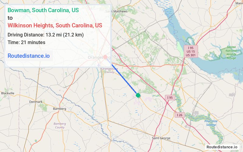
Distance from Bowman, South Carolina to Wilkinson Heights, South Carolina
The driving distance from Bowman, South Carolina to Wilkinson Heights, South Carolina is 17.1 mi (27.6 km)
The straight-line (air) distance is approximately 8.2 mi (13.2 km)
Estimated travel time by road is 21 minutes
We found 3 routes between Bowman and Wilkinson Heights.
Available Routes
Route Directions
Take Park St/State Rd S-38-152 and Rail St to US-178 W
Get on I-26 W
Follow I-26 W and US-301 S/Five Chop Rd to Oc 1197 in Wilkinson Heights
Route Directions
Get on I-26 W from Homestead Rd/State Rd S-38-36
Follow I-26 W to SC-33 S. Take exit 149 from I-26 W
Continue on SC-33 S. Drive to Oc 1197 in Wilkinson Heights
Route Directions
Journey Details
Traveling from Bowman, South Carolina to Wilkinson Heights, South Carolina covers 15 miles (24 km) in a northwest direction. This mixed highways and local roads, moderate route typically takes 19 minutes under normal conditions.
Drivers have 3 route options between these locations (15-20 miles / 24-32 km). The primary route shown here saves 4 minutes compared to alternatives.
Journey Waypoints
Bowman
Starting Point
Wilkinson Heights
Destination
Route Map Image