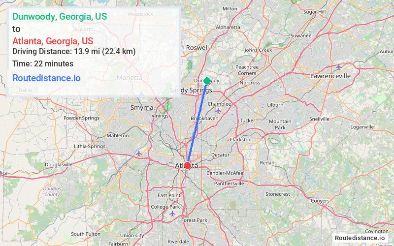
Distance from Dunwoody, Georgia to Atlanta, Georgia
The driving distance from Dunwoody, Georgia to Atlanta, Georgia is 16.5 mi (26.6 km)
The straight-line (air) distance is approximately 8.6 mi (13.9 km)
Estimated travel time by road is 22 minutes
We found 3 routes between Dunwoody and Atlanta.
Available Routes
Route Directions
Get on US-19 S in Sandy Springs from Mt Vernon Rd, Mount Vernon Hwy and Abernathy Rd NE
Take GA-400 S and I-85 S to M.L.K. Jr Dr SE in Atlanta. Take exit 248A from I-85 S
Route Directions
Get on I-285 W in Sandy Springs from Mt Vernon Rd, Mount Vernon Hwy and Exit 4B
Continue on I-285 W. Take I-75 S and I-85 S to M.L.K. Jr Dr SE in Atlanta. Take exit 248A from I-75 S/I-85 S
Route Directions
Get on US-19 S in Sandy Springs from Mt Vernon Rd, Mount Vernon Hwy and Abernathy Rd NE
Follow US-19 S and GA-400 S to Connector State Rd 141/Lenox Rd NE in Atlanta. Take exit 2 from GA-400 S
Get on I-75 S from Habersham Rd NE, Arden Rd NW and US-41 S/Northside Dr NW
Continue on I-75 S. Take I-85 S to M.L.K. Jr Dr SE. Take exit 248A from I-75 S/I-85 S
Journey Details
Traveling from Dunwoody, Georgia to Atlanta, Georgia covers 16.5 miles (27 km) in a south direction. This mixed highways and local roads, moderate route typically takes 22 minutes under normal conditions.
Drivers have 3 route options between these locations (17-22 miles / 27-35 km). The primary route shown here saves 12 minutes compared to alternatives.
The route features scenic views. During midday weekend travel, expect typical weekend traffic patterns with average speeds around 45 mph (72 km/h) .
Journey Waypoints
Dunwoody
Starting Point
Atlanta
Destination
Route Map Image