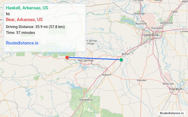
Distance from Haskell, Arkansas to Bear, Arkansas
The driving distance from Haskell, Arkansas to Bear, Arkansas is 48.1 mi (77.4 km)
The straight-line (air) distance is approximately 22.3 mi (35.9 km)
Estimated travel time by road is 55 minutes
We found 2 routes between Haskell and Bear.
Available Routes
Route Directions
Continue on US-67 S. Take I-30 W, US-270 W and Albert Pike Rd to Brady Mountain Cutoff in Royal
Continue on Brady Mountain Cutoff. Drive to State Hwy 926
Route Directions
Take US-70 W and US-270 W/Albert Pike Rd to Brady Mountain Cutoff in Royal
Continue on Brady Mountain Cutoff. Drive to State Hwy 926
Journey Details
Traveling from Haskell, Arkansas to Bear, Arkansas covers 46 miles (74 km) in a west direction. This highway, moderate route typically takes 52 minutes under normal conditions.
Drivers have 2 route options between these locations (46-48 miles / 74-77 km). The primary route shown here saves 4 minutes compared to alternatives.
The route features scenic views. During night weekday travel, expect minimal traffic congestion with average speeds around 56 mph (90 km/h) .
Journey Waypoints
Haskell
Starting Point
Bear
Destination
Route Map Image