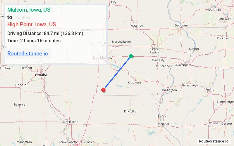
Distance from Malcom, Iowa to High Point, Iowa
The driving distance from Malcom, Iowa to High Point, Iowa is 137.7 mi (221.5 km)
The straight-line (air) distance is approximately 52.6 mi (84.7 km)
Estimated travel time by road is 2 hours 8 minutes
We found 3 routes between Malcom and High Point.
Available Routes
Route Directions
Get on I-80 W
Follow I-80 W and I-35 S to Elk St in Clarke County. Take exit 29 from I-35 S
Take Clarke-Decatur St and Co Rd R69 to IA-2 W in Decatur County
Route Directions
Get on I-80 W
Follow I-80 W and I-35 S to Co Rd J14 in Decatur County. Take exit 22 from I-35 S
Follow US-69 S to IA-2 E
Route Directions
Get on IA-163 W in Pella from 140th St and Co Hwy G5T
Continue on IA-163 W to Pella. Take exit 42 from IA-163 W
Follow Marion County Hwy T17 to IA-92 W
Continue on IA-92 W. Take IA-14 S and US-65 S to IA-2 W in Decatur County
Journey Details
Traveling from Malcom, Iowa to High Point, Iowa covers 113.1 miles (182 km) in a southwest direction. This mixed highways and local roads, substantial route typically takes 2 hours 8 minutes under normal conditions.
Drivers have 3 route options between these locations (113-139 miles / 182-224 km). The primary route shown here saves 9 seconds compared to alternatives.
The route features scenic views. During midday weekday travel, expect lighter midday traffic with average speeds around 51 mph (82 km/h) .
Journey Waypoints
Malcom
Starting Point
High Point
Destination
Route Map Image