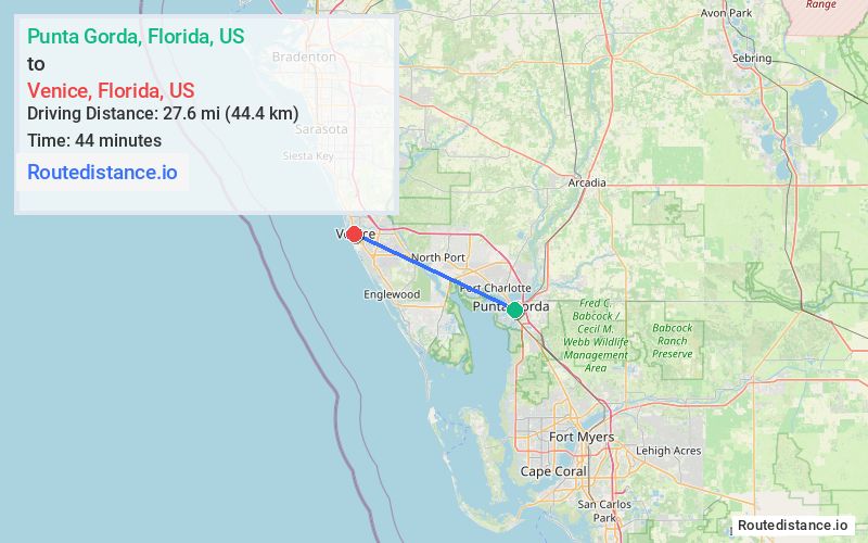
Distance from Punta Gorda, Florida to Venice, Florida
The driving distance from Punta Gorda, Florida to Venice, Florida is 37.2 mi (59.9 km)
The straight-line (air) distance is approximately 17.1 mi (27.6 km)
Estimated travel time by road is 43 minutes
We found 3 routes between Punta Gorda and Venice.
Available Routes
Route Directions
Get on I-75 N from Cooper St and US-17 N
Follow I-75 N to Jacaranda Blvd in Sarasota County. Take exit 193 from I-75 N
Drive to W Venice Ave in Venice
Route Directions
Take Taylor St to US-41 N/Tamiami Trl
Get on I-75 N in North Port
Follow I-75 N to Jacaranda Blvd. Take exit 193 from I-75 N
Drive to W Venice Ave in Venice
Route Directions
Take Taylor St to US-41 N/Tamiami Trl
Follow State Rte 777 to W Venice Ave in Venice
Journey Details
Traveling from Punta Gorda, Florida to Venice, Florida covers 30.3 miles (49 km) in a northwest direction. This secondary roads, moderate route typically takes 56 minutes under normal conditions.
Drivers have 3 route options between these locations (30-37 miles / 49-60 km). The primary route shown here saves no time compared to alternatives.
Journey Waypoints
Punta Gorda
Starting Point
Venice
Destination
Route Map Image