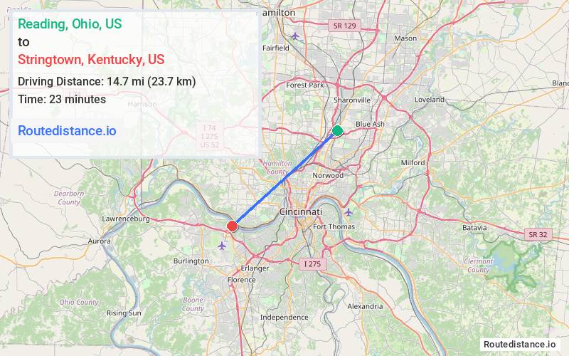
Distance from Reading, Ohio to Stringtown, Kentucky
The driving distance from Reading, Ohio to Stringtown, Kentucky is 32.7 mi (52.7 km)
The straight-line (air) distance is approximately 9.1 mi (14.7 km)
Estimated travel time by road is 35 minutes
We found 2 routes between Reading and Stringtown.
Available Routes
Route Directions
Get on I-75 S in Lockland from W Benson St and E Wyoming Ave
Follow I-75 S, I-471 S and I-275 W to KY-212 E in Boone County. Take exit 4A from I-275 W
Take KY-20 to KY-8 W
Route Directions
Get on I-75 S in Lockland from W Benson St and E Wyoming Ave
Continue on I-75 S to Boone County. Take exit 4A from I-275 W
Take KY-20 to KY-8 W
Journey Details
Traveling from Reading, Ohio to Stringtown, Kentucky covers 25 miles (40 km) in a southwest direction. This mixed highways and local roads, moderate route typically takes 29 minutes under normal conditions.
Drivers have 2 route options between these locations (25-33 miles / 40-53 km). The primary route shown here saves 7 minutes compared to alternatives.
Journey Waypoints
Reading
Starting Point
Stringtown
Destination
Route Map Image