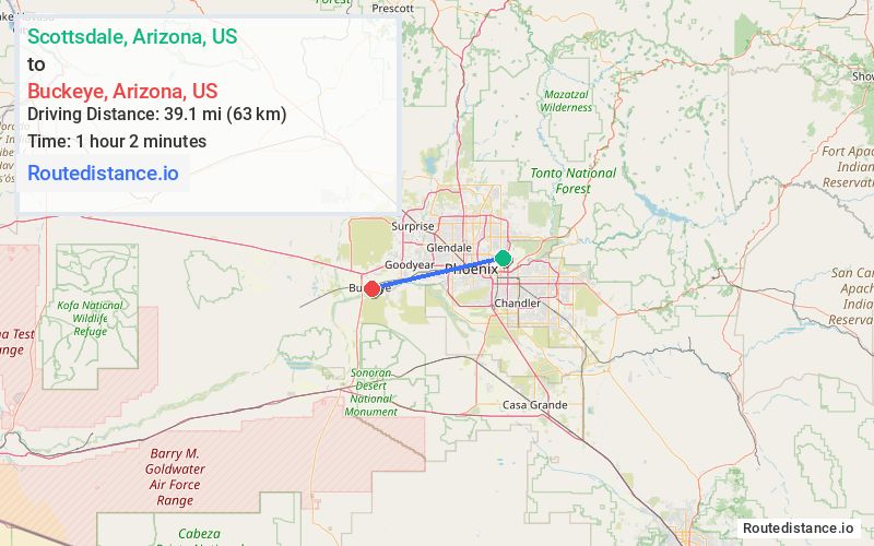
Distance from Scottsdale, Arizona to Buckeye, Arizona
The driving distance from Scottsdale, Arizona to Buckeye, Arizona is 46.4 mi (74.6 km)
The straight-line (air) distance is approximately 24.3 mi (39.1 km)
Estimated travel time by road is 55 minutes
This route includes Toll roads along the way.
We found 3 routes between Scottsdale and Buckeye.
Available Routes
Route Directions
Get on AZ-202/AZ-202 Loop W in Phoenix from E Indian School Rd, N 64th St, E McDowell Rd and N 52nd St
Take I-10 W to N Miller Rd in Buckeye. Take exit 114 from I-10 W
Follow N Miller Rd to Monroe Ave
Route Directions
Get on AZ-202/AZ-202 Loop W in Phoenix from E Indian School Rd, N 64th St, E McDowell Rd and N 52nd St
Take I-10 W to S Cotton Ln in Goodyear
Drive to W MC 85 in Buckeye
Route Directions
Get on AZ-101 Loop N from E Indian School Rd
Follow AZ-101 Loop N and I-10 W to N Miller Rd in Buckeye. Take exit 114 from I-10 W
Follow N Miller Rd to Monroe Ave
Journey Details
Traveling from Scottsdale, Arizona to Buckeye, Arizona covers 45.9 miles (74 km) in a west direction. This mixed highways and local roads, moderate route typically takes 57 minutes under normal conditions.
Drivers have 3 route options between these locations (46-72 miles / 74-116 km). The primary route shown here saves 18 minutes compared to alternatives.
Journey Waypoints
Scottsdale
Starting Point
Buckeye
Destination
Route Map Image