Distance to Bellamytown, Virginia

Calculating Your Route
Just a moment while we process your request...
Location Information
-
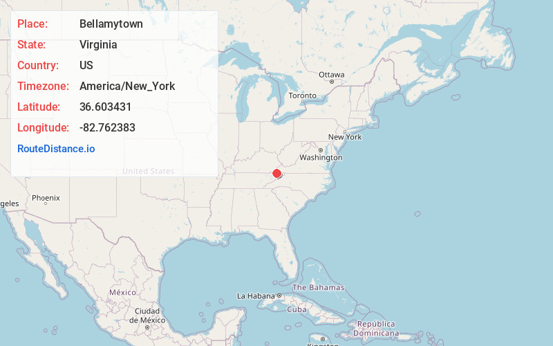
Full AddressBellamytown, VA 24251
-
Coordinates36.6034305, -82.762383
-
LocationVirginia , US
-
TimezoneAmerica/New_York
-
Current Local Time10:29:34 AM America/New_YorkWednesday, June 4, 2025
-
Page Views0
Nearby Places
Found 10 places within 50 miles

Okolona
1.6 mi
2.6 km
Okolona, TN 37642
Get directions
Long Hollow
3.2 mi
5.1 km
Long Hollow, Tennessee 37642
Get directions
Sloantown
3.2 mi
5.1 km
Sloantown, VA 24244
Get directions
Wininger
4.6 mi
7.4 km
Wininger, VA 24251
Get directions
Clinchport
5.2 mi
8.4 km
Clinchport, VA 24244
Get directions
New Canton
5.7 mi
9.2 km
New Canton, TN 37642
Get directions

Church Hill
6.2 mi
10.0 km
Church Hill, TN 37642
Get directions
Waycross
6.4 mi
10.3 km
Waycross, TN 37645
Get directions
Glenita
6.4 mi
10.3 km
Glenita, VA 24244
Get directions

Mt Carmel
6.9 mi
11.1 km
Mt Carmel, TN
Get directions
Location Links
Local Weather
Weather Information
Coming soon!
Location Map
Static map view of Bellamytown, Virginia
Browse Places by Distance
Places within specific distances from Bellamytown
Short Distances
Long Distances
Click any distance to see all places within that range from Bellamytown. Distances shown in miles (1 mile ≈ 1.61 kilometers).