Distance to Brink, Virginia

Calculating Your Route
Just a moment while we process your request...
Location Information
-
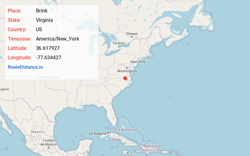
Full AddressBrink, VA 23879
-
Coordinates36.6179274, -77.6344271
-
LocationVirginia , US
-
TimezoneAmerica/New_York
-
Current Local Time9:47:19 AM America/New_YorkWednesday, June 25, 2025
-
Page Views0
About Brink
Brink is an unincorporated community in Greensville County, Virginia, United States. Brink is located within the vicinity of the intersections of Virginia Secondary Routes 627 and 633, southwest of the city of Emporia.
Nearby Places
Found 10 places within 50 miles

Mitchells Mill
3.8 mi
6.1 km
Mitchells Mill, VA 23879
Get directions
Barley
6.2 mi
10.0 km
Barley, VA 23847
Get directions

Emporia
6.9 mi
11.1 km
Emporia, VA 23847
Get directions
Durand
7.5 mi
12.1 km
Durand, VA 23847
Get directions
Stancell
7.8 mi
12.6 km
Stancell, NC 27832
Get directions
Fitzhugh
7.9 mi
12.7 km
Fitzhugh, VA 23868
Get directions
Pleasant Hill
8.1 mi
13.0 km
Pleasant Hill, NC 27866
Get directions
Gum Forks
8.1 mi
13.0 km
Gum Forks, NC 27831
Get directions

Gaston
8.2 mi
13.2 km
Gaston, NC
Get directions
Bufford Crossroads
8.3 mi
13.4 km
Bufford Crossroads, VA 23847
Get directions
Location Links
Local Weather
Weather Information
Coming soon!
Location Map
Static map view of Brink, Virginia
Browse Places by Distance
Places within specific distances from Brink
Short Distances
Long Distances
Click any distance to see all places within that range from Brink. Distances shown in miles (1 mile ≈ 1.61 kilometers).