Distance to Burns, Illinois

Calculating Your Route
Just a moment while we process your request...
Location Information
-
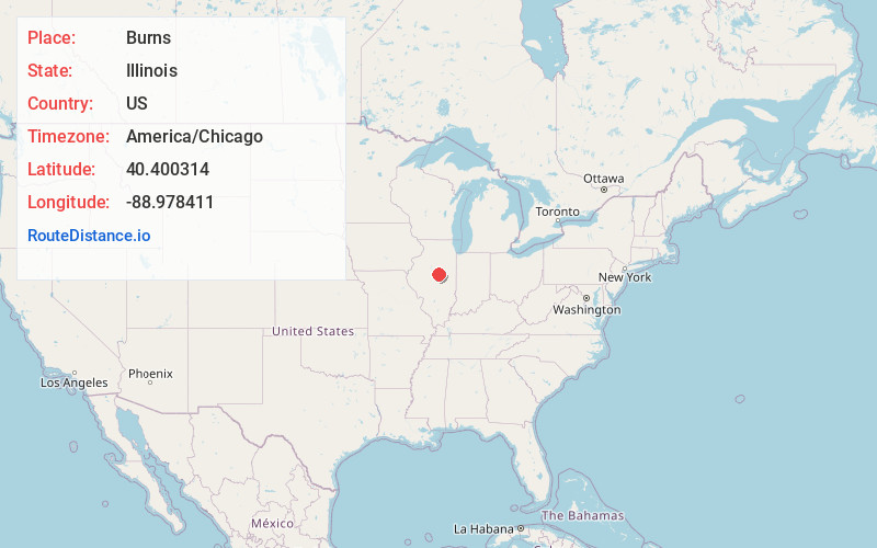
Full AddressBurns, Randolph Township, IL 61745
-
Coordinates40.400314, -88.9784107
-
LocationRandolph Township , Illinois , US
-
TimezoneAmerica/Chicago
-
Current Local Time9:53:12 AM America/ChicagoWednesday, May 21, 2025
-
Page Views0
Nearby Places
Found 10 places within 50 miles

Shirley
4.5 mi
7.2 km
Shirley, IL 61772
Get directions

Bloomington
5.3 mi
8.5 km
Bloomington, IL
Get directions

Downs
5.7 mi
9.2 km
Downs, IL
Get directions

Heyworth
6.0 mi
9.7 km
Heyworth, IL 61745
Get directions

Normal
7.9 mi
12.7 km
Normal, IL
Get directions

McLean
11.7 mi
18.8 km
McLean, IL 61754
Get directions

Le Roy
11.8 mi
19.0 km
Le Roy, IL 61752
Get directions

Towanda
12.1 mi
19.5 km
Towanda, IL
Get directions

Wapella
12.5 mi
20.1 km
Wapella, IL
Get directions

Stanford
12.8 mi
20.6 km
Stanford, IL 61774
Get directions
Location Links
Local Weather
Weather Information
Coming soon!
Location Map
Static map view of Burns, Illinois
Browse Places by Distance
Places within specific distances from Burns
Short Distances
Long Distances
Click any distance to see all places within that range from Burns. Distances shown in miles (1 mile ≈ 1.61 kilometers).