Distance to Cedar Swamp, South Carolina

Calculating Your Route
Just a moment while we process your request...
Location Information
-
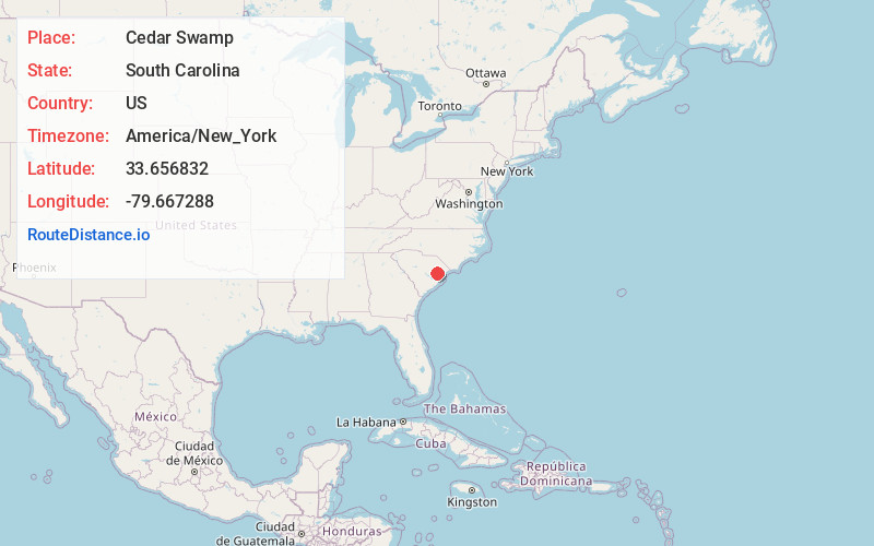
Full AddressCedar Swamp, SC 29556
-
Coordinates33.6568319, -79.6672879
-
LocationSouth Carolina , US
-
TimezoneAmerica/New_York
-
Current Local Time7:52:17 PM America/New_YorkThursday, June 19, 2025
-
Page Views0
Nearby Places
Found 10 places within 50 miles

Kingstree
9.4 mi
15.1 km
Kingstree, SC 29556
Get directions

Bryans Crossroads
10.3 mi
16.6 km
Bryans Crossroads, SC 29590
Get directions
Stuckey
10.3 mi
16.6 km
Stuckey, SC 29554
Get directions

Salters
11.4 mi
18.3 km
Salters, SC 29590
Get directions
Brunson Crossroads
12.6 mi
20.3 km
Brunson Crossroads, SC 29554
Get directions
Prospect Crossroads
13.7 mi
22.0 km
Prospect Crossroads, SC 29555
Get directions
Hogeye Crossroads
14.2 mi
22.9 km
Hogeye Crossroads, SC 29560
Get directions

Hemingway
14.3 mi
23.0 km
Hemingway, SC 29554
Get directions
Lane
15.3 mi
24.6 km
Lane, SC
Get directions

Andrews
15.5 mi
24.9 km
Andrews, SC 29510
Get directions
Location Links
Local Weather
Weather Information
Coming soon!
Location Map
Static map view of Cedar Swamp, South Carolina
Browse Places by Distance
Places within specific distances from Cedar Swamp
Short Distances
Long Distances
Click any distance to see all places within that range from Cedar Swamp. Distances shown in miles (1 mile ≈ 1.61 kilometers).