Distance to Clanton, Alabama
Location Information
-
Full AddressClanton, AL
-
Coordinates32.8387371, -86.6294262
-
LocationClanton , Alabama , US
-
TimezoneAmerica/Chicago
-
Current Local Time2:13:17 AM America/ChicagoThursday, May 15, 2025
-
Website
-
Page Views0
About Clanton
Clanton is a city in Chilton County, Alabama, United States. It is part of the Birmingham–Hoover–Cullman Combined Statistical Area. At the 2020 census, the population was 8,768. The city is the county seat of Chilton County. Clanton is near the site of the geographic center of the U.S. state of Alabama.


Nearby Places
Found 10 places within 50 miles

Calera
19.6 mi
31.5 km
Calera, AL
Get directions

Prattville
27.7 mi
44.6 km
Prattville, AL
Get directions

Millbrook
29.3 mi
47.2 km
Millbrook, AL
Get directions

Alabaster
30.0 mi
48.3 km
Alabaster, AL
Get directions

Sylacauga
31.8 mi
51.2 km
Sylacauga, AL
Get directions

Pelham
32.6 mi
52.5 km
Pelham, AL
Get directions

Helena
34.0 mi
54.7 km
Helena, AL
Get directions

Chelsea
34.6 mi
55.7 km
Chelsea, AL
Get directions


Leaflet © OpenStreetMap contributors
Location Links
Local Weather
Weather Information
Coming soon!
Location Map
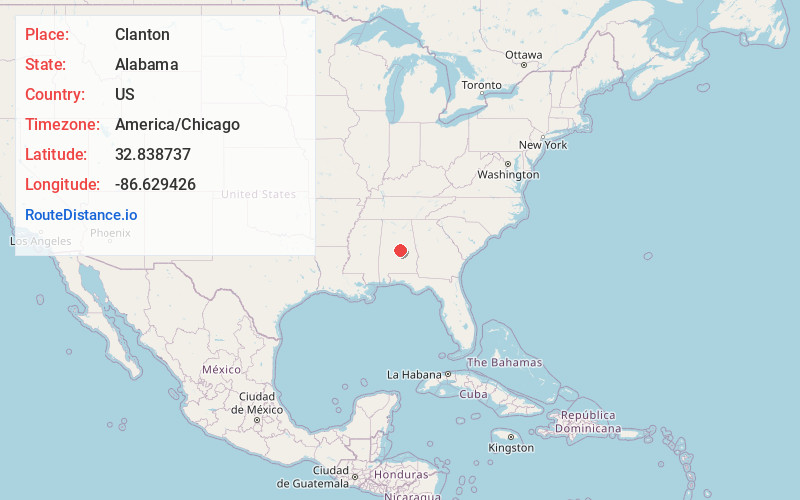
Static map view of Clanton, Alabama
Browse Places by Distance
Places within specific distances from Clanton
Short Distances
Long Distances
Click any distance to see all places within that range from Clanton. Distances shown in miles (1 mile ≈ 1.61 kilometers).