Distance to Clay Banks, Wisconsin

Calculating Your Route
Just a moment while we process your request...
Location Information
-
Full AddressClay Banks, WI
-
Coordinates44.7264015, -87.3563654
-
LocationClay Banks , Wisconsin , US
-
TimezoneAmerica/Chicago
-
Current Local Time9:15:58 AM America/ChicagoWednesday, June 18, 2025
-
Page Views0
About Clay Banks
Clay Banks is a town in Door County, Wisconsin, United States. The population was 410 at the 2000 census. The unincorporated communities of Salona, and Vignes are located in the town.


Nearby Places
Found 10 places within 50 miles

Vignes
1.0 mi
1.6 km
Vignes, Clay Banks, WI 54235
Get directions
Carnot
3.4 mi
5.5 km
Carnot, Forestville, WI 54213
Get directions
Maplewood
6.2 mi
10.0 km
Maplewood, WI 54235
Get directions
Forestville
6.5 mi
10.5 km
Forestville, WI 54213
Get directions

Sturgeon Bay
7.5 mi
12.1 km
Sturgeon Bay, WI 54235
Get directions
Stevens Hill
7.9 mi
12.7 km
Stevens Hill, Sturgeon Bay, WI 54235
Get directions
Kodan
8.3 mi
13.4 km
Kodan, Ahnapee, WI 54201
Get directions

Nasewaupee
8.4 mi
13.5 km
Nasewaupee, WI
Get directions

Algoma
8.9 mi
14.3 km
Algoma, WI 54201
Get directions
Kolberg
9.5 mi
15.3 km
Kolberg, Brussels, WI 54213
Get directions
Location Links
Local Weather
Weather Information
Coming soon!
Location Map
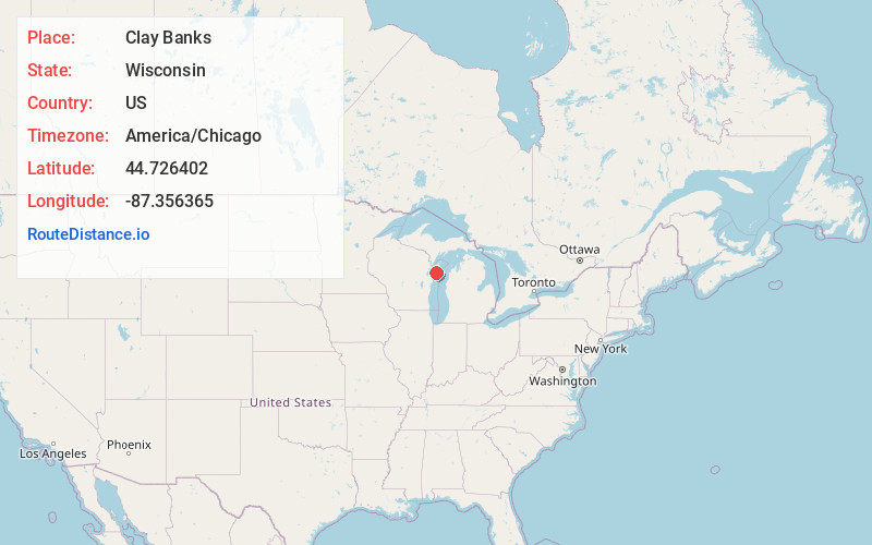
Static map view of Clay Banks, Wisconsin
Browse Places by Distance
Places within specific distances from Clay Banks
Short Distances
Long Distances
Click any distance to see all places within that range from Clay Banks. Distances shown in miles (1 mile ≈ 1.61 kilometers).