Distance to Columbia Station, Ohio

Calculating Your Route
Just a moment while we process your request...
Location Information
-
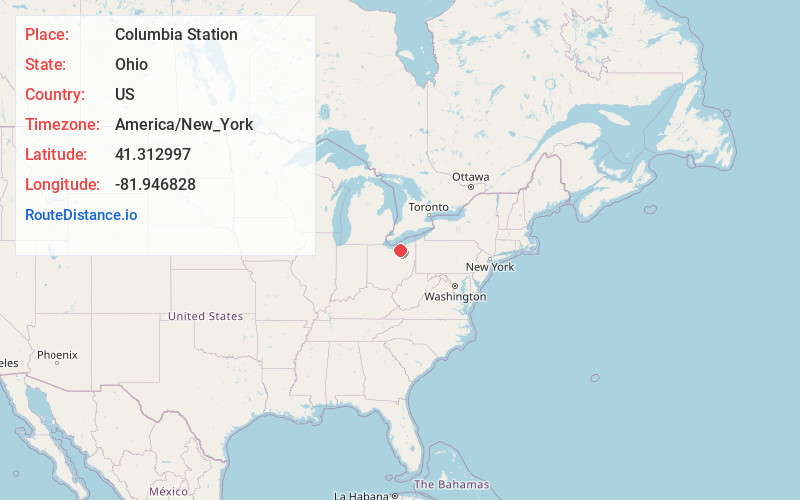
Full AddressColumbia Station, OH 44028
-
Coordinates41.3129972, -81.9468279
-
LocationColumbia Station , Ohio , US
-
TimezoneAmerica/New_York
-
Current Local Time1:45:54 AM America/New_YorkMonday, June 2, 2025
-
Page Views0
About Columbia Station
Columbia Township, also known as Columbia Station or just Columbia, is the easternmost of the eighteen townships of Lorain County, Ohio, United States. Columbia Township is the official government name, while Columbia Station is the post office name, and tends to be the town name used by residents.

Nearby Places
Found 10 places within 50 miles

Eaton Estates
3.1 mi
5.0 km
Eaton Estates, OH 44044
Get directions

Beebetown
4.4 mi
7.1 km
Beebetown, Liverpool Township, OH 44212
Get directions

Olmsted Falls
4.7 mi
7.6 km
Olmsted Falls, OH 44138
Get directions
Valley City
5.3 mi
8.5 km
Valley City, OH 44280
Get directions

Strongsville
5.8 mi
9.3 km
Strongsville, OH
Get directions

Berea
6.0 mi
9.7 km
Berea, OH 44017
Get directions

Grafton
6.3 mi
10.1 km
Grafton, OH
Get directions

North Ridgeville
6.5 mi
10.5 km
North Ridgeville, OH
Get directions
Belden
6.5 mi
10.5 km
Belden, Grafton Township, OH 44044
Get directions
Laporte
6.9 mi
11.1 km
Laporte, Carlisle Township, OH 44035
Get directions
Location Links
Local Weather
Weather Information
Coming soon!
Location Map
Static map view of Columbia Station, Ohio
Browse Places by Distance
Places within specific distances from Columbia Station
Short Distances
Long Distances
Click any distance to see all places within that range from Columbia Station. Distances shown in miles (1 mile ≈ 1.61 kilometers).