Distance to Ellerbees Mill, South Carolina

Calculating Your Route
Just a moment while we process your request...
Location Information
-
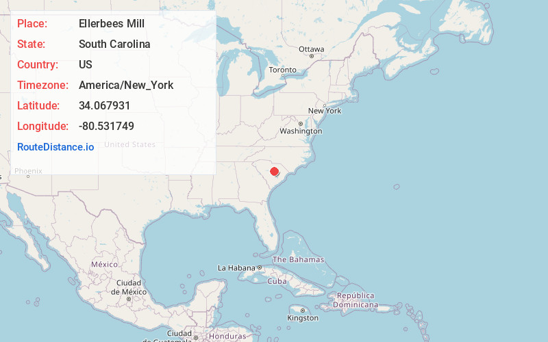
Full AddressEllerbees Mill, SC 29128
-
Coordinates34.0679311, -80.5317491
-
LocationSouth Carolina , US
-
TimezoneAmerica/New_York
-
Current Local Time6:07:53 AM America/New_YorkWednesday, June 18, 2025
-
Page Views0
Nearby Places
Found 10 places within 50 miles

Rembert
1.9 mi
3.1 km
Rembert, SC 29128
Get directions

Boykin
4.4 mi
7.1 km
Boykin, SC 29128
Get directions
Oakland
5.9 mi
9.5 km
Oakland, SC
Get directions

Dalzell
6.8 mi
10.9 km
Dalzell, SC
Get directions

Stateburg
7.6 mi
12.2 km
Stateburg, SC
Get directions
Cherryvale
8.8 mi
14.2 km
Cherryvale, SC 29154
Get directions
Ashwood
12.6 mi
20.3 km
Ashwood, SC
Get directions
Wedgefield
12.8 mi
20.6 km
Wedgefield, SC 29168
Get directions

Camden
13.1 mi
21.1 km
Camden, SC 29020
Get directions

Cane Savannah
13.6 mi
21.9 km
Cane Savannah, SC
Get directions
Location Links
Local Weather
Weather Information
Coming soon!
Location Map
Static map view of Ellerbees Mill, South Carolina
Browse Places by Distance
Places within specific distances from Ellerbees Mill
Short Distances
Long Distances
Click any distance to see all places within that range from Ellerbees Mill. Distances shown in miles (1 mile ≈ 1.61 kilometers).