Distance to Fort Recovery, Ohio

Calculating Your Route
Just a moment while we process your request...
Location Information
-
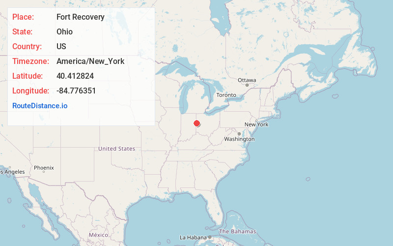
Full AddressFort Recovery, OH 45846
-
Coordinates40.4128241, -84.7763511
-
LocationFort Recovery , Ohio , US
-
TimezoneAmerica/New_York
-
Current Local Time6:30:53 AM America/New_YorkSaturday, June 7, 2025
-
Website
-
Page Views0
About Fort Recovery
Fort Recovery is a village in Mercer County, Ohio, United States. The population was 1,501 at the 2020 census. The village is near the location of Fort Recovery, first established in 1793 under orders from General Anthony Wayne. The town is located near the headwaters of the Wabash River.


Nearby Places
Found 10 places within 50 miles

St Henry
7.2 mi
11.6 km
St Henry, OH 45883
Get directions

Coldwater
9.1 mi
14.6 km
Coldwater, OH 45828
Get directions

Portland
10.7 mi
17.2 km
Portland, IN 47371
Get directions

Celina
14.3 mi
23.0 km
Celina, OH 45822
Get directions

Union City
14.7 mi
23.7 km
Union City, IN 47390
Get directions

Berne
19.3 mi
31.1 km
Berne, IN 46711
Get directions

Winchester
19.8 mi
31.9 km
Winchester, IN 47394
Get directions

Versailles
20.2 mi
32.5 km
Versailles, OH 45380
Get directions

New Bremen
20.9 mi
33.6 km
New Bremen, OH
Get directions

Minster
21.1 mi
34.0 km
Minster, OH 45865
Get directions
Location Links
Local Weather
Weather Information
Coming soon!
Location Map
Static map view of Fort Recovery, Ohio
Browse Places by Distance
Places within specific distances from Fort Recovery
Short Distances
Long Distances
Click any distance to see all places within that range from Fort Recovery. Distances shown in miles (1 mile ≈ 1.61 kilometers).