Distance to Gardendale, Alabama

Calculating Your Route
Just a moment while we process your request...
Location Information
-
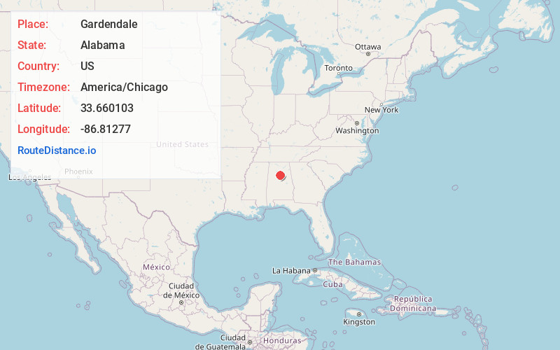
Full AddressGardendale, AL
-
Coordinates33.6601033, -86.8127702
-
LocationGardendale , Alabama , US
-
TimezoneAmerica/Chicago
-
Current Local Time1:53:20 AM America/ChicagoWednesday, June 25, 2025
-
Website
-
Page Views0
About Gardendale
Gardendale is a city in Jefferson County, Alabama, United States and a northern suburb of Birmingham. The population was 16,044 at the 2020 census.


Nearby Places
Found 10 places within 50 miles

Birmingham
9.8 mi
15.8 km
Birmingham, AL
Get directions

Mountain Brook
11.5 mi
18.5 km
Mountain Brook, AL
Get directions

Trussville
12.1 mi
19.5 km
Trussville, AL
Get directions

Homewood
13.0 mi
20.9 km
Homewood, AL
Get directions

Vestavia Hills
14.7 mi
23.7 km
Vestavia Hills, AL
Get directions

Hoover
17.6 mi
28.3 km
Hoover, AL
Get directions

Bessemer
19.6 mi
31.5 km
Bessemer, AL
Get directions

Helena
25.2 mi
40.6 km
Helena, AL
Get directions

Pelham
25.9 mi
41.7 km
Pelham, AL
Get directions

Alabaster
28.7 mi
46.2 km
Alabaster, AL
Get directions
Location Links
Local Weather
Weather Information
Coming soon!
Location Map
Static map view of Gardendale, Alabama
Browse Places by Distance
Places within specific distances from Gardendale
Short Distances
Long Distances
Click any distance to see all places within that range from Gardendale. Distances shown in miles (1 mile ≈ 1.61 kilometers).