Distance to Hooper, Utah

Calculating Your Route
Just a moment while we process your request...
Location Information
-
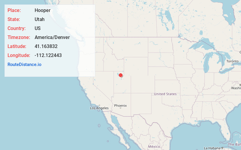
Full AddressHooper, UT
-
Coordinates41.1638323, -112.1224431
-
LocationHooper , Utah , US
-
TimezoneAmerica/Denver
-
Current Local Time4:47:11 PM America/DenverFriday, June 20, 2025
-
Website
-
Page Views0
About Hooper
Hooper is a city in Weber County, Utah, United States, first called Muskrat Springs and later Hooperville for Captain William Henry Hooper, an early Utah delegate to Congress. The population was 9,087 at the 2020 census, up from the 2010 figure of 6,932.


Nearby Places
Found 10 places within 50 miles

West Point
3.7 mi
6.0 km
West Point, UT
Get directions

Clinton
4.1 mi
6.6 km
Clinton, UT
Get directions

West Haven
4.6 mi
7.4 km
West Haven, UT 84401
Get directions

Roy
5.0 mi
8.0 km
Roy, UT
Get directions

Syracuse
6.0 mi
9.7 km
Syracuse, UT
Get directions

Clearfield
6.2 mi
10.0 km
Clearfield, UT
Get directions

Riverdale
6.2 mi
10.0 km
Riverdale, UT
Get directions

South Ogden
8.5 mi
13.7 km
South Ogden, UT
Get directions

Ogden
8.8 mi
14.2 km
Ogden, UT
Get directions

Layton
10.6 mi
17.1 km
Layton, UT
Get directions
Location Links
Local Weather
Weather Information
Coming soon!
Location Map
Static map view of Hooper, Utah
Browse Places by Distance
Places within specific distances from Hooper
Short Distances
Long Distances
Click any distance to see all places within that range from Hooper. Distances shown in miles (1 mile ≈ 1.61 kilometers).