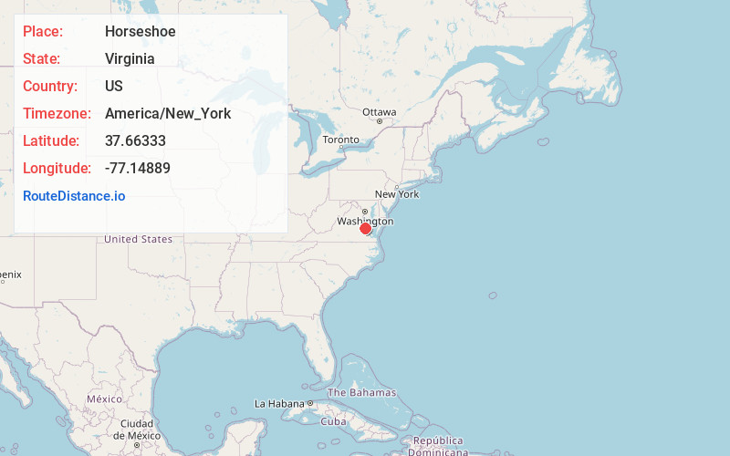
Distance to Horseshoe, Virginia

Calculating Your Route
Just a moment while we process your request...
Location Information
-
Full AddressHorseshoe, VA 23111
-
Coordinates37.66333, -77.14889
-
LocationHorseshoe , Virginia , US
-
TimezoneAmerica/New_York
-
Current Local Time3:57:20 PM America/New_YorkTuesday, June 10, 2025
-
Page Views0
About Horseshoe
Horseshoe is an unincorporated community in King William County, Virginia, United States.
Nearby Places
Found 10 places within 50 miles

Chericoke
2.8 mi
4.5 km
Chericoke, VA 23086
Get directions
Manquin
3.2 mi
5.1 km
Manquin, VA
Get directions
Westwood
4.5 mi
7.2 km
Westwood, VA 23111
Get directions
Putneys Mill
5.0 mi
8.0 km
Putneys Mill, VA 23124
Get directions
Central Garage
5.6 mi
9.0 km
Central Garage, VA
Get directions
Hanovertown
5.8 mi
9.3 km
Hanovertown, VA 23116
Get directions
Beaties Mill
6.4 mi
10.3 km
Beaties Mill, VA 23111
Get directions
Enfield
6.8 mi
10.9 km
Enfield, VA 23009
Get directions
Venter
6.9 mi
11.1 km
Venter, Central Garage, VA 23009
Get directions
Whitebank
7.4 mi
11.9 km
Whitebank, VA 23086
Get directions
Location Links
Local Weather
Weather Information
Coming soon!
Location Map
Static map view of Horseshoe, Virginia
Browse Places by Distance
Places within specific distances from Horseshoe
Short Distances
Long Distances
Click any distance to see all places within that range from Horseshoe. Distances shown in miles (1 mile ≈ 1.61 kilometers).