Distance to Howell, Michigan

Calculating Your Route
Just a moment while we process your request...
Location Information
-
Full AddressHowell, MI
-
Coordinates42.6072552, -83.9293952
-
LocationHowell , Michigan , US
-
TimezoneAmerica/Detroit
-
Current Local Time11:39:41 PM America/DetroitWednesday, June 18, 2025
-
Page Views0
About Howell
Howell is the largest city in and county seat of Livingston County, Michigan, United States. As of the 2020 census, the city had a population of 10,068. The city is mostly surrounded by Howell Township, but the two are administered autonomously.


Nearby Places
Found 10 places within 50 miles

South Lyon
17.4 mi
28.0 km
South Lyon, MI 48178
Get directions

Fenton
17.4 mi
28.0 km
Fenton, MI
Get directions

Wixom
20.8 mi
33.5 km
Wixom, MI
Get directions

Ann Arbor
24.5 mi
39.4 km
Ann Arbor, MI
Get directions

Novi
24.7 mi
39.8 km
Novi, MI
Get directions

Haslett
26.2 mi
42.2 km
Haslett, MI
Get directions

Okemos
26.5 mi
42.6 km
Okemos, MI
Get directions

Farmington Hills
29.6 mi
47.6 km
Farmington Hills, MI
Get directions

East Lansing
29.6 mi
47.6 km
East Lansing, MI
Get directions

Owosso
29.8 mi
48.0 km
Owosso, MI 48867
Get directions
Location Links
Local Weather
Weather Information
Coming soon!
Location Map
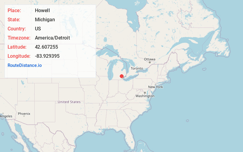
Static map view of Howell, Michigan
Browse Places by Distance
Places within specific distances from Howell
Short Distances
Long Distances
Click any distance to see all places within that range from Howell. Distances shown in miles (1 mile ≈ 1.61 kilometers).