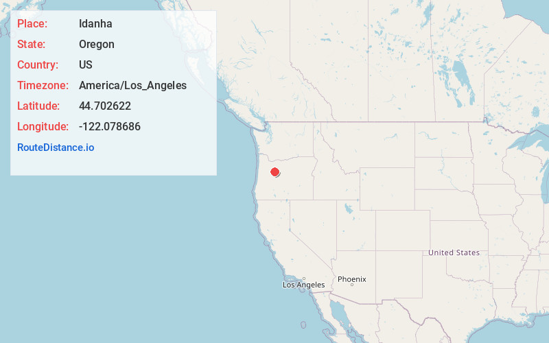
Distance to Idanha, Oregon

Calculating Your Route
Just a moment while we process your request...
Location Information
-
Full AddressIdanha, OR 97350
-
Coordinates44.7026218, -122.0786856
-
LocationIdanha , Oregon , US
-
TimezoneAmerica/Los_Angeles
-
Current Local Time6:33:02 PM America/Los_AngelesMonday, June 23, 2025
-
Website
-
Page Views0
About Idanha
Idanha is a city on the Marion County/Linn County line in Oregon, United States, on Oregon Route 22 and the Santiam River. The population was 156 at the 2020 census.


Nearby Places
Found 10 places within 50 miles

Gates
17.0 mi
27.4 km
Gates, OR
Get directions

Mill City
19.9 mi
32.0 km
Mill City, OR
Get directions

Lyons
26.8 mi
43.1 km
Lyons, OR 97358
Get directions

Camp Sherman
27.2 mi
43.8 km
Camp Sherman, OR 97730
Get directions

Mehama
27.2 mi
43.8 km
Mehama, OR
Get directions

Lacomb
33.6 mi
54.1 km
Lacomb, OR 97355
Get directions

Stayton
35.8 mi
57.6 km
Stayton, OR
Get directions

Sublimity
36.2 mi
58.3 km
Sublimity, OR 97385
Get directions

Scotts Mills
37.2 mi
59.9 km
Scotts Mills, OR
Get directions

Scio
37.8 mi
60.8 km
Scio, OR 97374
Get directions
Location Links
Local Weather
Weather Information
Coming soon!
Location Map
Static map view of Idanha, Oregon
Browse Places by Distance
Places within specific distances from Idanha
Short Distances
Long Distances
Click any distance to see all places within that range from Idanha. Distances shown in miles (1 mile ≈ 1.61 kilometers).