Distance to Kelleytown, Georgia

Calculating Your Route
Just a moment while we process your request...
Location Information
-
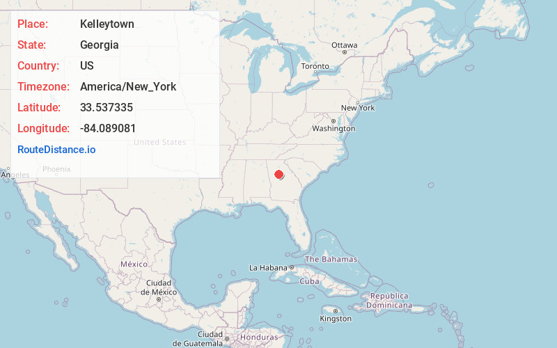
Full AddressKelleytown, GA 30252
-
Coordinates33.5373347, -84.0890813
-
LocationGeorgia , US
-
TimezoneAmerica/New_York
-
Current Local Time11:31:10 AM America/New_YorkThursday, June 5, 2025
-
Page Views0
About Kelleytown
Kelleytown is an unincorporated community in Henry County, Georgia, United States. Kelleytown is within the postal limits of McDonough and as such, most residents list McDonough as their city. The community is located eight miles northeast of the historic downtown McDonough Square.

Nearby Places
Found 10 places within 50 miles

Magnet
4.7 mi
7.6 km
Magnet, GA 30094
Get directions

McDonough
6.9 mi
11.1 km
McDonough, GA
Get directions
Ola
7.5 mi
12.1 km
Ola, GA 30252
Get directions
Pace
7.8 mi
12.6 km
Pace, GA 30016
Get directions

Stockbridge
8.1 mi
13.0 km
Stockbridge, GA
Get directions
Panola
9.4 mi
15.1 km
Panola, Stonecrest, GA 30294
Get directions
Fairview
9.5 mi
15.3 km
Fairview, GA 30016
Get directions
Scarbrough Cross Roads
9.9 mi
15.9 km
Scarbrough Cross Roads, GA 30294
Get directions

Conyers
9.9 mi
15.9 km
Conyers, GA
Get directions
Almon
11.2 mi
18.0 km
Almon, GA 30014
Get directions
Location Links
Local Weather
Weather Information
Coming soon!
Location Map
Static map view of Kelleytown, Georgia
Browse Places by Distance
Places within specific distances from Kelleytown
Short Distances
Long Distances
Click any distance to see all places within that range from Kelleytown. Distances shown in miles (1 mile ≈ 1.61 kilometers).