Distance to Mandeville, Georgia

Calculating Your Route
Just a moment while we process your request...
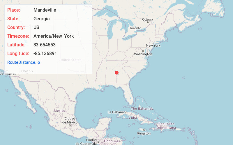
Location Information
-
Full AddressMandeville, GA 30117
-
Coordinates33.6545528, -85.1368914
-
LocationGeorgia , US
-
TimezoneAmerica/New_York
-
Current Local Time3:16:47 PM America/New_YorkWednesday, June 18, 2025
-
Page Views0
Nearby Places
Found 10 places within 50 miles

Mt Zion
3.2 mi
5.1 km
Mt Zion, GA
Get directions

Waco
4.3 mi
6.9 km
Waco, GA
Get directions

Bremen
4.6 mi
7.4 km
Bremen, GA
Get directions

Carrollton
6.2 mi
10.0 km
Carrollton, GA
Get directions

West Bremen
7.0 mi
11.3 km
West Bremen, GA 30110
Get directions
West Crossing
8.1 mi
13.0 km
West Crossing, GA 30176
Get directions

Temple
8.3 mi
13.4 km
Temple, GA 30179
Get directions
Jonesville
8.5 mi
13.7 km
Jonesville, GA 30108
Get directions
Farmers High
8.9 mi
14.3 km
Farmers High, GA 30117
Get directions
Sand Hill
9.5 mi
15.3 km
Sand Hill, GA 30116
Get directions
Location Links
Local Weather
Weather Information
Coming soon!
Location Map
Static map view of Mandeville, Georgia
Browse Places by Distance
Places within specific distances from Mandeville
Short Distances
Long Distances
Click any distance to see all places within that range from Mandeville. Distances shown in miles (1 mile ≈ 1.61 kilometers).