Distance to Maysville, Kentucky

Calculating Your Route
Just a moment while we process your request...
Location Information
-
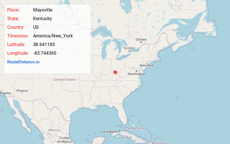
Full AddressMaysville, KY 41056
-
Coordinates38.6411854, -83.744365
-
LocationMaysville , Kentucky , US
-
TimezoneAmerica/New_York
-
Current Local Time5:32:31 AM America/New_YorkThursday, May 22, 2025
-
Page Views0
About Maysville
Maysville is a "home rule" class city in Mason County, Kentucky, United States, and is the county seat of Mason County. The population was 8,873 as of the 2020 census. Maysville is on the Ohio River, 66 miles northeast of Lexington.


Nearby Places
Found 7 places within 50 miles

Amelia
36.9 mi
59.4 km
Amelia, OH
Get directions

Paris
40.6 mi
65.3 km
Paris, KY 40361
Get directions

Portsmouth
40.8 mi
65.7 km
Portsmouth, OH 45662
Get directions

Alexandria
41.0 mi
66.0 km
Alexandria, KY 41001
Get directions

Independence
47.9 mi
77.1 km
Independence, KY
Get directions

Bainbridge
47.9 mi
77.1 km
Bainbridge, OH 45612
Get directions

Fort Thomas
48.3 mi
77.7 km
Fort Thomas, KY
Get directions
Location Links
Local Weather
Weather Information
Coming soon!
Location Map
Static map view of Maysville, Kentucky
Browse Places by Distance
Places within specific distances from Maysville
Short Distances
Long Distances
Click any distance to see all places within that range from Maysville. Distances shown in miles (1 mile ≈ 1.61 kilometers).