Distance to Mt Clare, West Virginia

Calculating Your Route
Just a moment while we process your request...
Location Information
-
Full AddressMt Clare, WV
-
Coordinates39.2154953, -80.3452508
-
LocationMt Clare , West Virginia , US
-
TimezoneAmerica/New_York
-
Current Local Time9:42:00 PM America/New_YorkMonday, June 23, 2025
-
Page Views0
About Mt Clare
Mount Clare is an unincorporated community in Harrison County, West Virginia, United States. Mount Clare is 4.5 miles south of Clarksburg. Mount Clare has a post office with ZIP code 26408.
Nearby Places
Found 10 places within 50 miles

Spring Hill Chapel
2.4 mi
3.9 km
Spring Hill Chapel, WV 26301
Get directions
Quiet Dell
2.8 mi
4.5 km
Quiet Dell, WV 26408
Get directions

Stonewood
3.0 mi
4.8 km
Stonewood, WV 26301
Get directions

West Milford
3.3 mi
5.3 km
West Milford, WV
Get directions

Nutter Fort
3.6 mi
5.8 km
Nutter Fort, WV 26301
Get directions

Lost Creek
3.8 mi
6.1 km
Lost Creek, WV 26385
Get directions
Craigmoor
3.8 mi
6.1 km
Craigmoor, WV 26301
Get directions

Anmoore
4.0 mi
6.4 km
Anmoore, WV
Get directions
East View
4.1 mi
6.6 km
East View, WV 26301
Get directions

Clarksburg
4.5 mi
7.2 km
Clarksburg, WV
Get directions
Location Links
Local Weather
Weather Information
Coming soon!
Location Map
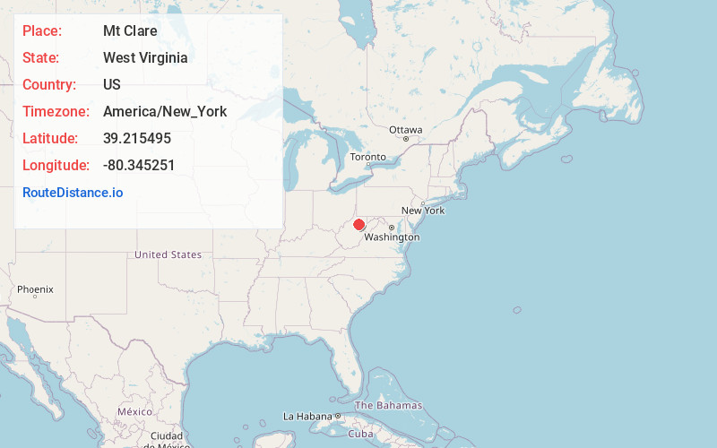
Static map view of Mt Clare, West Virginia
Browse Places by Distance
Places within specific distances from Mt Clare
Short Distances
Long Distances
Click any distance to see all places within that range from Mt Clare. Distances shown in miles (1 mile ≈ 1.61 kilometers).