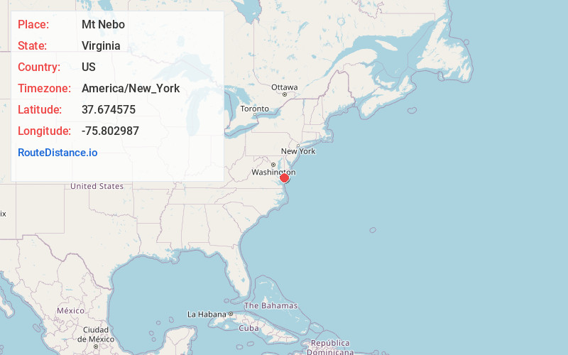
Distance to Mt Nebo, Virginia

Calculating Your Route
Just a moment while we process your request...
Location Information
-
Full AddressMt Nebo, VA 23417
-
Coordinates37.6745752, -75.8029868
-
LocationVirginia , US
-
TimezoneAmerica/New_York
-
Current Local Time7:05:14 PM America/New_YorkFriday, June 20, 2025
-
Page Views0
Nearby Places
Found 10 places within 50 miles

Bobtown
1.7 mi
2.7 km
Bobtown, VA 23410
Get directions
Harborton
1.7 mi
2.7 km
Harborton, VA 23389
Get directions
Smithville
2.3 mi
3.7 km
Smithville, VA 23358
Get directions
Savageville
2.7 mi
4.3 km
Savageville, VA 23417
Get directions

Pungoteague
3.1 mi
5.0 km
Pungoteague, VA
Get directions
East Point
3.2 mi
5.1 km
East Point, VA 23417
Get directions
Melfa
3.8 mi
6.1 km
Melfa, VA 23410
Get directions

Onancock
3.9 mi
6.3 km
Onancock, VA 23417
Get directions
Keller
4.4 mi
7.1 km
Keller, VA
Get directions

Onley
4.9 mi
7.9 km
Onley, VA
Get directions
Location Links
Local Weather
Weather Information
Coming soon!
Location Map
Static map view of Mt Nebo, Virginia
Browse Places by Distance
Places within specific distances from Mt Nebo
Short Distances
Long Distances
Click any distance to see all places within that range from Mt Nebo. Distances shown in miles (1 mile ≈ 1.61 kilometers).