Distance to Myricks Mill, Georgia

Calculating Your Route
Just a moment while we process your request...
Location Information
-
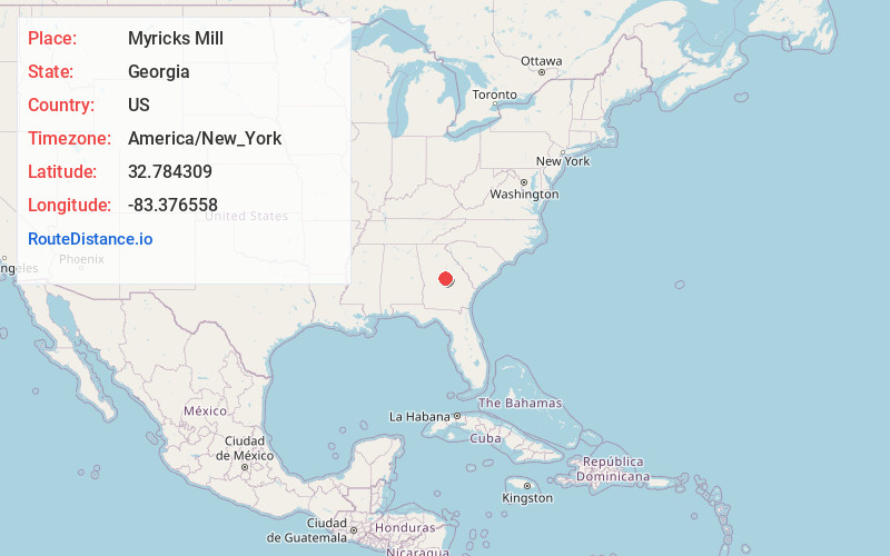
Full AddressMyricks Mill, GA 31044
-
Coordinates32.7843085, -83.3765576
-
LocationGeorgia , US
-
TimezoneAmerica/New_York
-
Current Local Time8:54:09 PM America/New_YorkTuesday, June 17, 2025
-
Page Views0
About Myricks Mill
Myrick's Mill is a populated place in Twiggs County, Georgia. Originally known as Big Sandy, for a large creek in the area, the settlement included a post office, churches, sawmills, ice house and J.D. Myrick's grist mill. Residents produced cotton, fruits and vegetables.
Nearby Places
Found 10 places within 50 miles

Jeffersonville
6.9 mi
11.1 km
Jeffersonville, GA 31044
Get directions

Gordon
7.2 mi
11.6 km
Gordon, GA 31031
Get directions

Ivey
9.7 mi
15.6 km
Ivey, GA 31031
Get directions

Edgars
10.4 mi
16.7 km
Edgars, McIntyre, GA 31054
Get directions

McIntyre
11.4 mi
18.3 km
McIntyre, GA 31054
Get directions

Irwinton
12.0 mi
19.3 km
Irwinton, GA
Get directions
Postell
12.6 mi
20.3 km
Postell, GA 31211
Get directions
Bullard
12.7 mi
20.4 km
Bullard, GA 31020
Get directions

Danville
14.5 mi
23.3 km
Danville, GA 31017
Get directions

Macon
15.3 mi
24.6 km
Macon, GA
Get directions
Location Links
Local Weather
Weather Information
Coming soon!
Location Map
Static map view of Myricks Mill, Georgia
Browse Places by Distance
Places within specific distances from Myricks Mill
Short Distances
Long Distances
Click any distance to see all places within that range from Myricks Mill. Distances shown in miles (1 mile ≈ 1.61 kilometers).