Distance to Oven Fork, Kentucky

Calculating Your Route
Just a moment while we process your request...
Location Information
-
Full AddressOven Fork, KY 40823
-
Coordinates37.0592642, -82.8084935
-
LocationOven Fork , Kentucky , US
-
TimezoneAmerica/New_York
-
Current Local Time10:32:31 PM America/New_YorkWednesday, June 25, 2025
-
Page Views0
About Oven Fork
Oven Fork is an unincorporated community in Letcher County, Kentucky. Oven Fork is located on U.S. Route 119 and the Cumberland River 4.2 miles south of Whitesburg.
The first of two post offices to serve the community was established on February 6, 1879, with David M. Collier as its postmaster.


Nearby Places
Found 10 places within 50 miles

Eolia
1.0 mi
1.6 km
Eolia, KY 40826
Get directions

Day
2.3 mi
3.7 km
Day, KY 41858
Get directions
Dongola
3.3 mi
5.3 km
Dongola, KY 41858
Get directions

Whitesburg
4.2 mi
6.8 km
Whitesburg, KY 41858
Get directions
Ermine
4.4 mi
7.1 km
Ermine, KY 41837
Get directions
Marlowe
5.1 mi
8.2 km
Marlowe, KY 41858
Get directions
Oscaloosa
5.1 mi
8.2 km
Oscaloosa, KY 41858
Get directions
Bellcraft
5.3 mi
8.5 km
Bellcraft, KY 41858
Get directions
Kings Creek
5.9 mi
9.5 km
Kings Creek, KY 41858
Get directions
Flat Gap
5.9 mi
9.5 km
Flat Gap, VA 24279
Get directions
Location Links
Local Weather
Weather Information
Coming soon!
Location Map
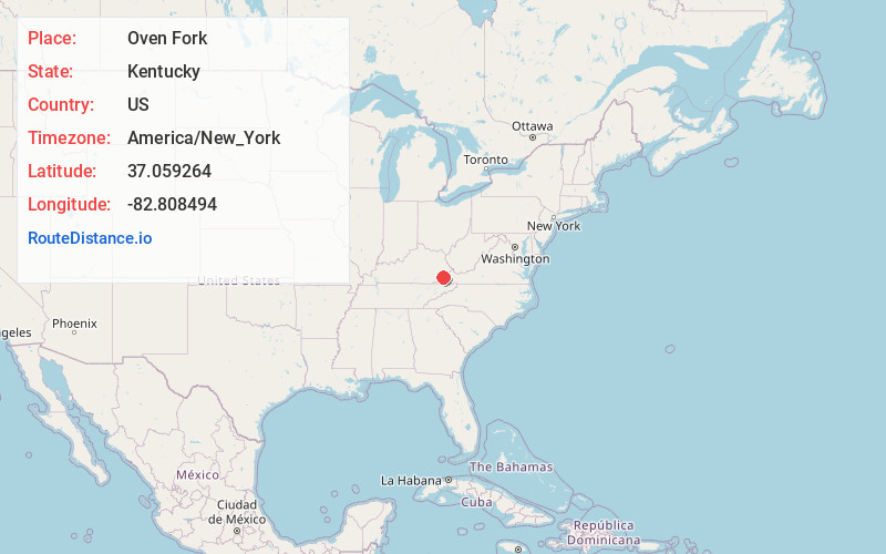
Static map view of Oven Fork, Kentucky
Browse Places by Distance
Places within specific distances from Oven Fork
Short Distances
Long Distances
Click any distance to see all places within that range from Oven Fork. Distances shown in miles (1 mile ≈ 1.61 kilometers).