Distance to Post Oak, Missouri

Calculating Your Route
Just a moment while we process your request...
Location Information
-
Full AddressPost Oak, MO 64761
-
Coordinates38.5689051, -93.7510478
-
LocationPost Oak , Missouri , US
-
TimezoneAmerica/Chicago
-
Current Local Time1:05:43 AM America/ChicagoWednesday, May 21, 2025
-
Page Views0
About Post Oak
Post Oak is an unincorporated community in Johnson County, in the U.S. state of Missouri.
The community is located on Missouri Route 13. The Rock Island Trail runs just north of the community.
Nearby Places
Found 10 places within 50 miles

Leeton
3.2 mi
5.1 km
Leeton, MO 64761
Get directions

Chilhowee
5.8 mi
9.3 km
Chilhowee, MO 64733
Get directions
Old Chilhowee
6.0 mi
9.7 km
Old Chilhowee, Chilhowee Township, MO 64733
Get directions
New Castle
6.2 mi
10.0 km
New Castle, Jefferson Township, MO 64761
Get directions
Quarles
6.8 mi
10.9 km
Quarles, MO 64735
Get directions

Calhoun
9.7 mi
15.6 km
Calhoun, MO 65323
Get directions
Denton
10.1 mi
16.3 km
Denton, Chilhowee Township, MO 64040
Get directions
Bristle Ridge
11.2 mi
18.0 km
Bristle Ridge, MO 64093
Get directions
Blairstown
11.4 mi
18.3 km
Blairstown, MO 64726
Get directions

Windsor
12.6 mi
20.3 km
Windsor, MO 65360
Get directions
Location Links
Local Weather
Weather Information
Coming soon!
Location Map
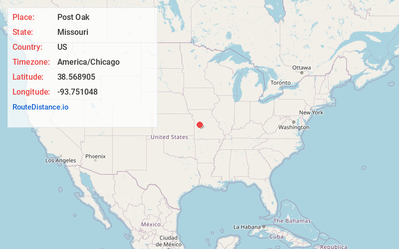
Static map view of Post Oak, Missouri
Browse Places by Distance
Places within specific distances from Post Oak
Short Distances
Long Distances
Click any distance to see all places within that range from Post Oak. Distances shown in miles (1 mile ≈ 1.61 kilometers).