Distance to Remington, Virginia

Calculating Your Route
Just a moment while we process your request...
Location Information
-
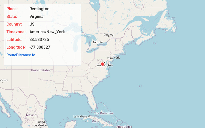
Full AddressRemington, VA
-
Coordinates38.5337354, -77.8083266
-
LocationRemington , Virginia , US
-
TimezoneAmerica/New_York
-
Current Local Time1:04:31 PM America/New_YorkThursday, June 19, 2025
-
Page Views0
About Remington
Remington is a town in Fauquier County, Virginia, United States. The population was 598 at the 2010 census. It is near the highways, U.S. Route 15, U.S. Route 17, U.S. Route 29, and Virginia State Route 28. Remington is less than a mile northeast of the Culpeper County line.


Nearby Places
Found 10 places within 50 miles

Bealeton
4.1 mi
6.6 km
Bealeton, VA 22712
Get directions

Culpeper
11.0 mi
17.7 km
Culpeper, VA 22701
Get directions

Warrenton
12.4 mi
20.0 km
Warrenton, VA
Get directions

New Baltimore
16.7 mi
26.9 km
New Baltimore, VA
Get directions

Nokesville
16.8 mi
27.0 km
Nokesville, VA 20181
Get directions
Southern Gateway
20.8 mi
33.5 km
Southern Gateway, VA 22406
Get directions

Gainesville
20.9 mi
33.6 km
Gainesville, VA
Get directions

Haymarket
21.4 mi
34.4 km
Haymarket, VA
Get directions

Brightwood
22.2 mi
35.7 km
Brightwood, VA
Get directions

Stafford
23.0 mi
37.0 km
Stafford, VA 22554
Get directions
Location Links
Local Weather
Weather Information
Coming soon!
Location Map
Static map view of Remington, Virginia
Browse Places by Distance
Places within specific distances from Remington
Short Distances
Long Distances
Click any distance to see all places within that range from Remington. Distances shown in miles (1 mile ≈ 1.61 kilometers).