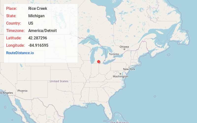
Distance to Rice Creek, Michigan

Calculating Your Route
Just a moment while we process your request...
Location Information
-
Full AddressRice Creek, Michigan
-
Coordinates42.287296, -84.9165945
-
LocationMichigan , US
-
TimezoneAmerica/Detroit
-
Current Local Time1:53:16 PM America/DetroitSaturday, June 7, 2025
-
Page Views0
Nearby Places
Found 10 places within 50 miles

Marshall
2.6 mi
4.2 km
Marshall, MI 49068
Get directions

Marengo
3.6 mi
5.8 km
Marengo, MI 49224
Get directions

Walnut Point
5.6 mi
9.0 km
Walnut Point, Convis Township, MI 49068
Get directions
Eckford
6.4 mi
10.3 km
Eckford, MI 49245
Get directions

Ceresco
7.5 mi
12.1 km
Ceresco, MI
Get directions
Babcock
7.7 mi
12.4 km
Babcock, Albion Township, MI 49224
Get directions
Lee Center
8.4 mi
13.5 km
Lee Center, Lee Township, MI 49076
Get directions

Albion
8.9 mi
14.3 km
Albion, MI 49224
Get directions
Condit
9.5 mi
15.3 km
Condit, Albion Township, MI 49245
Get directions
Wattles Park
10.0 mi
16.1 km
Wattles Park, Emmett Township, MI 49014
Get directions
Location Links
Local Weather
Weather Information
Coming soon!
Location Map
Static map view of Rice Creek, Michigan
Browse Places by Distance
Places within specific distances from Rice Creek
Short Distances
Long Distances
Click any distance to see all places within that range from Rice Creek. Distances shown in miles (1 mile ≈ 1.61 kilometers).