Distance to Sechelt, British Columbia

Calculating Your Route
Just a moment while we process your request...
Location Information
-
Full AddressSechelt, BC, Canada
-
Coordinates49.4741736, -123.7545601
-
LocationSechelt , British Columbia , CA
-
TimezoneAmerica/Vancouver
-
Current Local Time11:14:32 PM America/VancouverWednesday, July 2, 2025
-
Website
-
Page Views0
About Sechelt
Sechelt is a district municipality located on the lower Sunshine Coast of British Columbia. Approximately 50 kilometres northwest of Vancouver, it is accessible from mainland British Columbia by a ...


Nearby Places
Found 10 places within 50 miles

Gibsons
12.0 mi
19.3 km
Gibsons, BC, Canada
Get directions

Nanaimo
22.9 mi
36.9 km
Nanaimo, BC, Canada
Get directions

Stanley Park
29.9 mi
48.1 km
Stanley Park, Vancouver, BC V6G 1Z4, Canada
Get directions

Squamish
31.1 mi
50.1 km
Squamish, BC, Canada
Get directions

Granville Island
31.2 mi
50.2 km
Granville Island, Vancouver, BC, Canada
Get directions

Vancouver
31.4 mi
50.5 km
Vancouver, BC, Canada
Get directions

Qualicum Beach
32.1 mi
51.7 km
Qualicum Beach, BC, Canada
Get directions

Ladysmith
33.2 mi
53.4 km
Ladysmith, BC, Canada
Get directions

Richmond
35.1 mi
56.5 km
Richmond, BC, Canada
Get directions

Burnaby
38.2 mi
61.5 km
Burnaby, BC, Canada
Get directions
Location Links
Local Weather
Weather Information
Coming soon!
Location Map
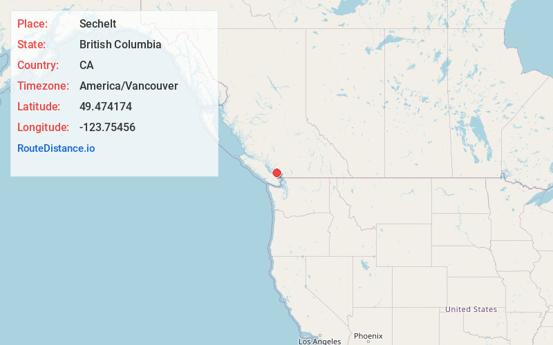
Static map view of Sechelt, British Columbia
Browse Places by Distance
Places within specific distances from Sechelt
Short Distances
Long Distances
Click any distance to see all places within that range from Sechelt. Distances shown in miles (1 mile ≈ 1.61 kilometers).