Distance to Shady Point, Oklahoma

Calculating Your Route
Just a moment while we process your request...
Location Information
-
Full AddressShady Point, OK 74956
-
Coordinates35.1303155, -94.6585647
-
LocationShady Point , Oklahoma , US
-
TimezoneAmerica/Chicago
-
Current Local Time5:38:58 PM America/ChicagoFriday, June 20, 2025
-
Page Views0
About Shady Point
Shady Point, sometimes referred to as Shadypoint, is a town in Le Flore County, Oklahoma, United States. It is part of the Fort Smith, Arkansas-Oklahoma Metropolitan Statistical Area. The population was 1,026 at the 2010 census, a 21.0 percent increase over the figure of 848 recorded in 2000.


Nearby Places
Found 10 places within 50 miles

Panama
2.7 mi
4.3 km
Panama, OK
Get directions

Poteau
5.7 mi
9.2 km
Poteau, OK
Get directions

Spiro
8.0 mi
12.9 km
Spiro, OK 74959
Get directions

Pocola
12.4 mi
20.0 km
Pocola, OK
Get directions

Heavener
16.5 mi
26.6 km
Heavener, OK 74937
Get directions

Muldrow
19.4 mi
31.2 km
Muldrow, OK 74948
Get directions

Arkoma
19.9 mi
32.0 km
Arkoma, OK 74901
Get directions

Roland
21.7 mi
34.9 km
Roland, OK
Get directions

Fort Smith
22.1 mi
35.6 km
Fort Smith, AR
Get directions

Greenwood
23.4 mi
37.7 km
Greenwood, AR 72936
Get directions
Location Links
Local Weather
Weather Information
Coming soon!
Location Map
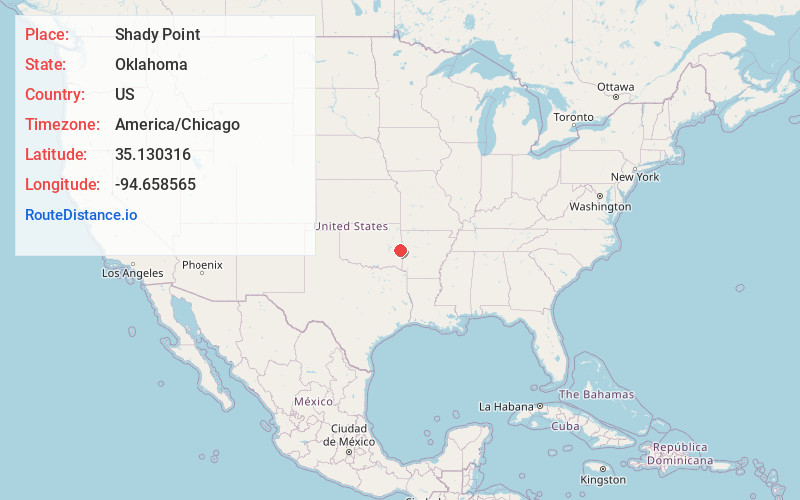
Static map view of Shady Point, Oklahoma
Browse Places by Distance
Places within specific distances from Shady Point
Short Distances
Long Distances
Click any distance to see all places within that range from Shady Point. Distances shown in miles (1 mile ≈ 1.61 kilometers).