Distance to Upper Elochoman, Washington

Calculating Your Route
Just a moment while we process your request...
Location Information
-
Full AddressUpper Elochoman, WA 98612
-
Coordinates46.241557, -123.3206736
-
LocationUpper Elochoman , Washington , US
-
TimezoneAmerica/Los_Angeles
-
Current Local Time1:14:36 AM America/Los_AngelesWednesday, June 18, 2025
-
Page Views0
About Upper Elochoman
Upper Elochoman is a census-designated place in Wahkiakum County, Washington, United States. The population was 193 at the 2010 census. The CDP includes the State Camp community.
Nearby Places
Found 10 places within 50 miles

Lower Elochoman
2.7 mi
4.3 km
Lower Elochoman, WA 98612
Get directions

East Cathlamet
3.8 mi
6.1 km
East Cathlamet, WA 98612
Get directions

Cathlamet
4.0 mi
6.4 km
Cathlamet, WA 98612
Get directions
Puget Island Range
5.4 mi
8.7 km
Puget Island Range, Washington 98612
Get directions

Westport
8.0 mi
12.9 km
Westport, OR 97016
Get directions

Clatskanie
11.0 mi
17.7 km
Clatskanie, OR 97016
Get directions

Knappa
13.2 mi
21.2 km
Knappa, OR 97103
Get directions

Grays River
15.9 mi
25.6 km
Grays River, WA
Get directions

Ryderwood
16.2 mi
26.1 km
Ryderwood, WA 98581
Get directions

Rosburg
16.4 mi
26.4 km
Rosburg, WA
Get directions
Location Links
Local Weather
Weather Information
Coming soon!
Location Map
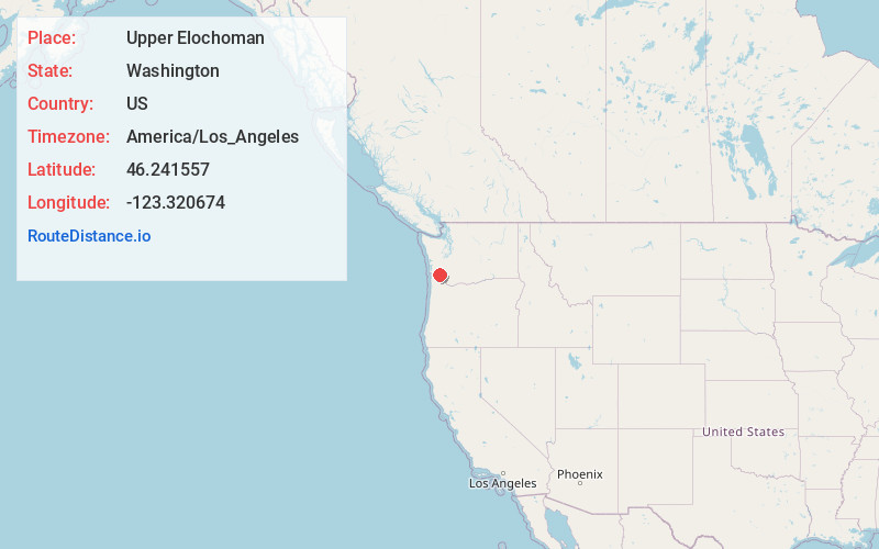
Static map view of Upper Elochoman, Washington
Browse Places by Distance
Places within specific distances from Upper Elochoman
Short Distances
Long Distances
Click any distance to see all places within that range from Upper Elochoman. Distances shown in miles (1 mile ≈ 1.61 kilometers).