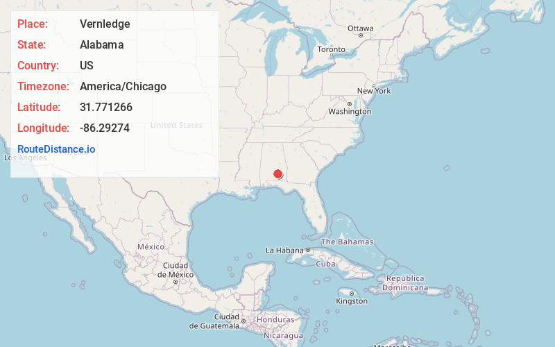
Distance to Vernledge, Alabama

Calculating Your Route
Just a moment while we process your request...
Location Information
-
Full AddressVernledge, AL 36049
-
Coordinates31.771266, -86.2927404
-
LocationAlabama , US
-
TimezoneAmerica/Chicago
-
Current Local Time1:25:47 PM America/ChicagoTuesday, July 1, 2025
-
Page Views0
Nearby Places
Found 10 places within 50 miles

Rutledge
3.0 mi
4.8 km
Rutledge, AL
Get directions

Fullers Crossroads
3.4 mi
5.5 km
Fullers Crossroads, AL 36049
Get directions
Live Oak
3.7 mi
6.0 km
Live Oak, AL 36049
Get directions

Luverne
4.1 mi
6.6 km
Luverne, AL 36049
Get directions
Moodys Crossroads
6.5 mi
10.5 km
Moodys Crossroads, AL 36071
Get directions

Petrey
7.3 mi
11.7 km
Petrey, AL 36049
Get directions
Garnersville
7.3 mi
11.7 km
Garnersville, AL 36041
Get directions
Joquin
7.6 mi
12.2 km
Joquin, AL 36049
Get directions
Center Ridge
7.7 mi
12.4 km
Center Ridge, AL 36049
Get directions
Shirleys Crossroads
8.5 mi
13.7 km
Shirleys Crossroads, AL 36035
Get directions
Location Links
Local Weather
Weather Information
Coming soon!
Location Map
Static map view of Vernledge, Alabama
Browse Places by Distance
Places within specific distances from Vernledge
Short Distances
Long Distances
Click any distance to see all places within that range from Vernledge. Distances shown in miles (1 mile ≈ 1.61 kilometers).