Distance to Wattis, Utah

Calculating Your Route
Just a moment while we process your request...
Location Information
-
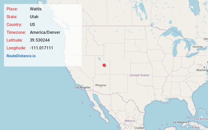
Full AddressWattis, UT
-
Coordinates39.5302439, -111.0171114
-
LocationUtah , US
-
TimezoneAmerica/Denver
-
Current Local Time6:17:41 PM America/DenverFriday, June 20, 2025
-
Page Views0
Nearby Places
Found 10 places within 50 miles

Hiawatha
3.2 mi
5.1 km
Hiawatha, UT 84501
Get directions

Wildcat
9.8 mi
15.8 km
Wildcat, UT 84526
Get directions
West Wood
10.7 mi
17.2 km
West Wood, UT 84501
Get directions

Clear Creek
10.7 mi
17.2 km
Clear Creek, UT 84526
Get directions

Price
12.0 mi
19.3 km
Price, UT 84501
Get directions

Spring Glen
12.5 mi
20.1 km
Spring Glen, UT 84526
Get directions

Standardville
12.5 mi
20.1 km
Standardville, UT 84526
Get directions
Latuda
12.6 mi
20.3 km
Latuda, UT 84526
Get directions

Helper
13.7 mi
22.0 km
Helper, UT 84526
Get directions

Huntington
14.3 mi
23.0 km
Huntington, UT 84528
Get directions
Location Links
Local Weather
Weather Information
Coming soon!
Location Map
Static map view of Wattis, Utah
Browse Places by Distance
Places within specific distances from Wattis
Short Distances
Long Distances
Click any distance to see all places within that range from Wattis. Distances shown in miles (1 mile ≈ 1.61 kilometers).