Distance to West Point, Virginia

Calculating Your Route
Just a moment while we process your request...
Location Information
-
Full AddressWest Point, VA 23181
-
Coordinates37.5315335, -76.7963504
-
LocationWest Point , Virginia , US
-
TimezoneAmerica/New_York
-
Current Local Time5:23:32 AM America/New_YorkWednesday, June 18, 2025
-
Page Views0
About West Point
West Point is an incorporated town in King William County, Virginia, United States. The population was 3,414 at the 2020 census.


Nearby Places
Found 10 places within 50 miles

Williamsburg
18.3 mi
29.5 km
Williamsburg, VA
Get directions

Sandston
28.5 mi
45.9 km
Sandston, VA
Get directions

Highland Springs
29.1 mi
46.8 km
Highland Springs, VA
Get directions

Hopewell
31.2 mi
50.2 km
Hopewell, VA 23860
Get directions

Montrose
31.9 mi
51.3 km
Montrose, VA
Get directions
Enon
32.0 mi
51.5 km
Enon, VA 23836
Get directions

Mechanicsville
32.0 mi
51.5 km
Mechanicsville, VA
Get directions

Richmond
35.1 mi
56.5 km
Richmond, VA
Get directions
Chamberlayne
35.2 mi
56.6 km
Chamberlayne, VA
Get directions

Newport News
35.5 mi
57.1 km
Newport News, VA
Get directions
Location Links
Local Weather
Weather Information
Coming soon!
Location Map
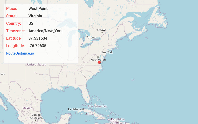
Static map view of West Point, Virginia
Browse Places by Distance
Places within specific distances from West Point
Short Distances
Long Distances
Click any distance to see all places within that range from West Point. Distances shown in miles (1 mile ≈ 1.61 kilometers).