Distance to Yacolt, Washington

Calculating Your Route
Just a moment while we process your request...
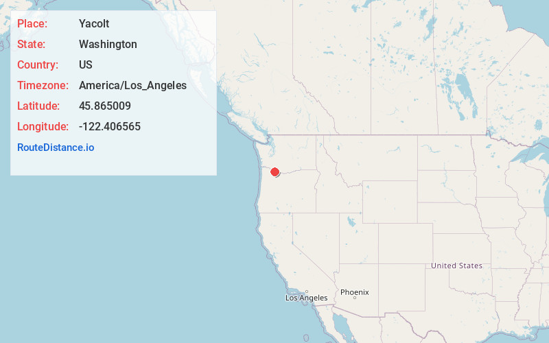
Location Information
-
Full AddressYacolt, WA 98675
-
Coordinates45.8650087, -122.4065651
-
LocationYacolt , Washington , US
-
TimezoneAmerica/Los_Angeles
-
Current Local Time4:01:56 PM America/Los_AngelesFriday, June 20, 2025
-
Page Views0
About Yacolt
Yacolt is a town in Clark County, Washington, United States. The 2023 population is estimated to be 1,626. It is located about 30 miles northeast of Vancouver which is part of the Portland-Vancouver metropolitan area.


Nearby Places
Found 10 places within 50 miles

Amboy
3.7 mi
6.0 km
Amboy, WA
Get directions

Venersborg
6.1 mi
9.8 km
Venersborg, WA 98604
Get directions

Lewisville
6.8 mi
10.9 km
Lewisville, WA 98604
Get directions

Battle Ground
8.6 mi
13.8 km
Battle Ground, WA
Get directions

Hockinson
9.6 mi
15.4 km
Hockinson, WA
Get directions
Meadow Glade
10.4 mi
16.7 km
Meadow Glade, WA 98604
Get directions

Brush Prairie
11.3 mi
18.2 km
Brush Prairie, WA
Get directions
Duluth
12.7 mi
20.4 km
Duluth, WA 98642
Get directions

La Center
12.8 mi
20.6 km
La Center, WA
Get directions

Orchards
13.2 mi
21.2 km
Orchards, WA
Get directions
Location Links
Local Weather
Weather Information
Coming soon!
Location Map
Static map view of Yacolt, Washington
Browse Places by Distance
Places within specific distances from Yacolt
Short Distances
Long Distances
Click any distance to see all places within that range from Yacolt. Distances shown in miles (1 mile ≈ 1.61 kilometers).