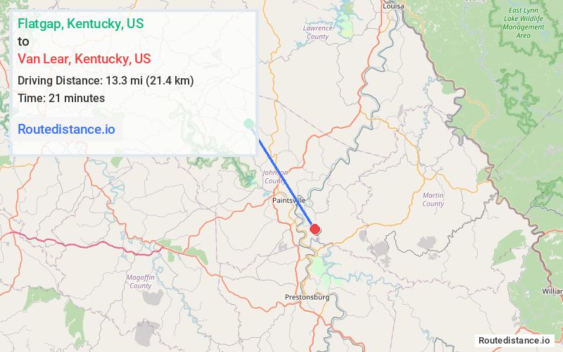
Distance from Flatgap, Kentucky to Van Lear, Kentucky
The driving distance from Flatgap, Kentucky to Van Lear, Kentucky is 20 mi (32.2 km)
The straight-line (air) distance is approximately 8.3 mi (13.3 km)
Estimated travel time by road is 28 minutes
We found 2 routes between Flatgap and Van Lear.
Available Routes
Route Directions
Follow State Hwy 1092 to KY-201 S in Sitka
Continue on KY-201 S. Take US-23 S to Millers Creek Rd in Van Lear
Follow Millers Creek Rd to Possum Hollow Rd
Route Directions
Follow State Hwy 689 to KY-172 E
Continue on KY-172 E. Take US-23 S/US-460 E to State Hwy 1428 in Paintsville
Follow State Hwy 1428 and KY-302 S to Possum Hollow Rd in Van Lear
Journey Details
Traveling from Flatgap, Kentucky to Van Lear, Kentucky covers 18.4 miles (30 km) in a southeast direction. This secondary roads, moderate route typically takes 27 minutes under normal conditions.
Drivers have 2 route options between these locations (18-20 miles / 30-32 km). The primary route shown here saves 2 minutes compared to alternatives.
The route features scenic views. During midday weekday travel, expect lighter midday traffic with average speeds around 40 mph (64 km/h) .
Journey Waypoints
Flatgap
Starting Point
Van Lear
Destination
Route Map Image