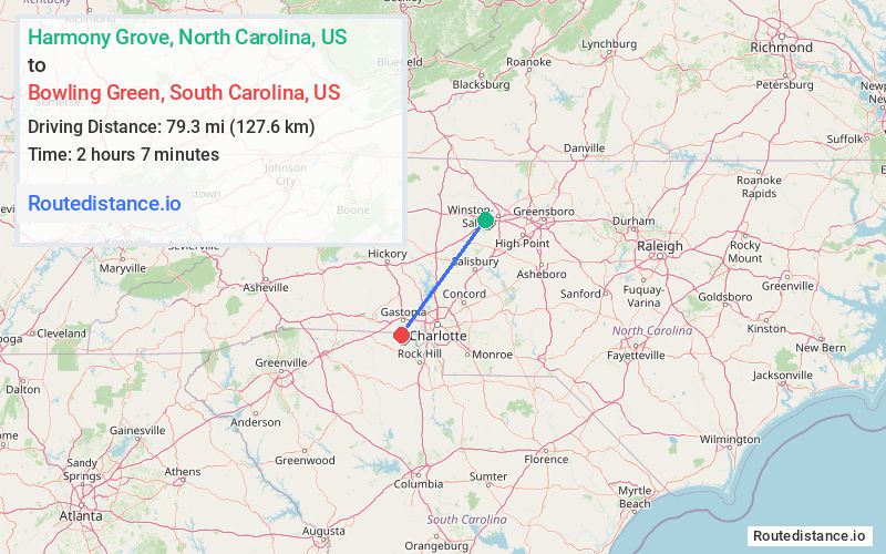
Distance from Harmony Grove, North Carolina to Bowling Green, South Carolina
The driving distance from Harmony Grove, North Carolina to Bowling Green, South Carolina is 108.8 mi (175.1 km)
The straight-line (air) distance is approximately 49.3 mi (79.3 km)
Estimated travel time by road is 1 hour 49 minutes
We found 3 routes between Harmony Grove and Bowling Green.
Available Routes
Route Directions
Get on I-40 in Clemmons from Lewisville Clemmons Rd
Follow I-40 to US-321 S in York County
Route Directions
Get on US-421 S from Styers Ferry Rd
Follow I-285/US-52 S and I-85 S to S Main St in Lowell. Take exit 22 from I-85 S
Take Redbud Dr, Hoffman Rd and Robinson Rd to US-321 S in York County
Route Directions
Get on I-40 in Clemmons from Styers Ferry Rd and Lewisville Clemmons Rd
Continue on I-40. Take I-77 S, I-485 Outer and I-85 S to S Main St in Lowell. Take exit 22 from I-85 S
Take Redbud Dr, Hoffman Rd and Robinson Rd to US-321 S in York County
Journey Details
Traveling from Harmony Grove, North Carolina to Bowling Green, South Carolina covers 99 miles (159 km) in a southwest direction. This mixed highways and local roads, substantial route typically takes 1 hour 43 minutes under normal conditions.
Drivers have 3 route options between these locations (99-110 miles / 159-178 km). The primary route shown here saves 8 minutes compared to alternatives.
The route features scenic views, toll sections. During night weekday travel, expect minimal traffic congestion with average speeds around 55 mph (89 km/h) .
Journey Waypoints
Harmony Grove
Starting Point
Bowling Green
Destination
Route Map Image