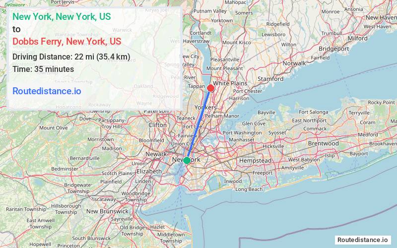
Distance from New York, New York to Dobbs Ferry, New York
The driving distance from New York, New York to Dobbs Ferry, New York is 24.2 mi (39 km)
The straight-line (air) distance is approximately 13.7 mi (22 km)
Estimated travel time by road is 48 minutes
This route includes Toll roads along the way.
We found 3 routes between New York and Dobbs Ferry.
Available Routes
Route Directions
Take Murray St to NY-9A N/West St
Continue to The Bronx
Continue on Saw Mill Riv Pkwy N to your destination in Dobbs Ferry
Route Directions
Take Frankfort St and South St to FDR Dr
Continue on FDR Dr. Take I-87 N to Saw Mill Pkwy N/Saw Mill Riv Pkwy N in The Bronx. Take the Saw Mill Pkwy exit from Mosholu Pkwy
Continue on Saw Mill Pkwy N/Saw Mill Riv Pkwy N to your destination in Dobbs Ferry
Route Directions
Get on FDR Dr from Frankfort St
Follow FDR Dr and I-87 N to NY-9A N/Saw Mill River Rd in Ardsley. Take exit 7 from I-87 N
Take Ashford Ave to your destination in Dobbs Ferry
Journey Details
Traveling from New York, New York to Dobbs Ferry, New York covers 25.7 miles (41 km) in a northeast direction. This secondary roads, moderate route typically takes 46 minutes under normal conditions.
Drivers have 3 route options between these locations (24-27 miles / 39-44 km). The primary route shown here saves no time compared to alternatives.
The route features scenic views. During midday weekday travel, expect lighter midday traffic with average speeds around 30 mph (48 km/h) .
Journey Waypoints
New York
Starting Point
Dobbs Ferry
Destination
Route Map Image