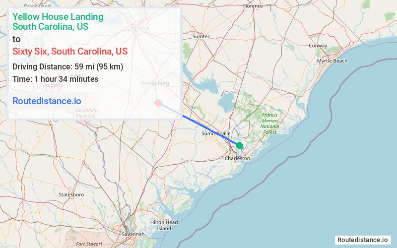
Distance from Yellow House Landing, South Carolina to Sixty Six, South Carolina
The driving distance from Yellow House Landing, South Carolina to Sixty Six, South Carolina is 71.8 mi (115.6 km)
The straight-line (air) distance is approximately 36.7 mi (59 km)
Estimated travel time by road is 1 hour 15 minutes
We found 2 routes between Yellow House Landing and Sixty Six.
Available Routes
Route Directions
Take Clements Ferry Rd/State Rd S-8-33 to I-526 W
Take I-26 W to SC-210 W/Vance Rd in Orangeburg County. Take exit 165 from I-26 W
Continue on SC-210 W/Vance Rd. Drive to Sixty Six Rd
Route Directions
Take Clements Ferry Rd/State Rd S-8-33 to I-526 W
Take I-26 W and US-78 E to Sixty Six Rd in Orangeburg County
Journey Details
Traveling from Yellow House Landing, South Carolina to Sixty Six, South Carolina covers 69 miles (111 km) in a northwest direction. This mixed highways and local roads, substantial route typically takes 1 hour 19 minutes under normal conditions.
Drivers have 2 route options between these locations (69-72 miles / 111-116 km). The primary route shown here saves no time compared to alternatives.
The route features scenic views. During night weekday travel, expect minimal traffic congestion with average speeds around 49 mph (79 km/h) .
Journey Waypoints
Yellow House Landing
Starting Point
Sixty Six
Destination
Route Map Image