Distance to Avondale Estates, Georgia

Calculating Your Route
Just a moment while we process your request...
Location Information
-
Full AddressAvondale Estates, GA
-
Coordinates33.7714939, -84.2671444
-
LocationAvondale Estates , Georgia , US
-
TimezoneAmerica/New_York
-
Current Local Time3:35:13 PM America/New_YorkWednesday, May 21, 2025
-
Website
-
Page Views0
About Avondale Estates
Avondale Estates is a city in DeKalb County, Georgia, United States. The population was 3,567 in 2020. It is part of the Atlanta metropolitan area and is near Decatur.


Nearby Places
Found 10 places within 50 miles

Scottdale
1.3 mi
2.1 km
Scottdale, GA
Get directions

Belvedere Park
1.5 mi
2.4 km
Belvedere Park, GA
Get directions

Decatur
1.7 mi
2.7 km
Decatur, GA
Get directions

North Decatur
2.6 mi
4.2 km
North Decatur, GA
Get directions

Clarkston
3.1 mi
5.0 km
Clarkston, GA
Get directions
Candler-McAfee
3.2 mi
5.1 km
Candler-McAfee, GA 30032
Get directions
Panthersville
4.4 mi
7.1 km
Panthersville, GA 30034
Get directions
Gresham Park
5.4 mi
8.7 km
Gresham Park, GA
Get directions

Stone Mountain
6.1 mi
9.8 km
Stone Mountain, GA
Get directions

Tucker
6.4 mi
10.3 km
Tucker, GA
Get directions
Location Links
Local Weather
Weather Information
Coming soon!
Location Map
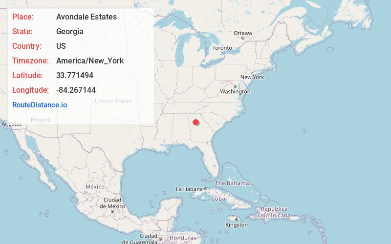
Static map view of Avondale Estates, Georgia
Browse Places by Distance
Places within specific distances from Avondale Estates
Short Distances
Long Distances
Click any distance to see all places within that range from Avondale Estates. Distances shown in miles (1 mile ≈ 1.61 kilometers).