Distance to Bethlehem, Missouri

Calculating Your Route
Just a moment while we process your request...
Location Information
-
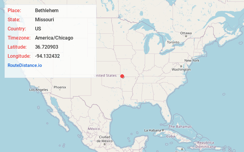
Full AddressBethlehem, Richwood Township, MO 64861
-
Coordinates36.7209027, -94.1324316
-
LocationRichwood Township , Missouri , US
-
TimezoneAmerica/Chicago
-
Current Local Time2:35:26 AM America/ChicagoFriday, June 20, 2025
-
Page Views0
Nearby Places
Found 10 places within 50 miles

Rocky Comfort
2.9 mi
4.7 km
Rocky Comfort, MO 64861
Get directions

Stella
4.3 mi
6.9 km
Stella, MO 64867
Get directions

Wheaton
5.1 mi
8.2 km
Wheaton, MO
Get directions

Fairview
7.1 mi
11.4 km
Fairview, MO 64842
Get directions

Pioneer
9.0 mi
14.5 km
Pioneer, MO 64842
Get directions

McCullough Ford
9.2 mi
14.8 km
McCullough Ford, Center Township, MO 65730
Get directions
Stark City
10.2 mi
16.4 km
Stark City, MO 64866
Get directions

Exeter
11.2 mi
18.0 km
Exeter, MO 65647
Get directions

Newtonia
11.2 mi
18.0 km
Newtonia, MO 64866
Get directions
Meadors Ford
11.5 mi
18.5 km
Meadors Ford, Pineville North Township, MO 64856
Get directions
Location Links
Local Weather
Weather Information
Coming soon!
Location Map
Static map view of Bethlehem, Missouri
Browse Places by Distance
Places within specific distances from Bethlehem
Short Distances
Long Distances
Click any distance to see all places within that range from Bethlehem. Distances shown in miles (1 mile ≈ 1.61 kilometers).